|
search place name
|
||
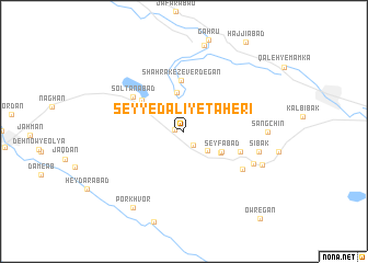
Seyyed ‘Ālī-ye Ţāherī (Chahār Maḩāll va Bakhtīār, Iran)Seyyed ‘Ālī-ye Ţāherī is a town in the Chahār Maḩāll va Bakhtīār region of Iran. An overview map of the region around Seyyed ‘Ālī-ye Ţāherī is displayed below.
regional and 3d topo map of Seyyed ‘Ālī-ye Ţāherī, Iran ::
Seyyed ‘Ālī-ye Ţāherī airports ::
The nearest airport is QMJ - Masjed Soleiman Shahid Asyaee, located 151.0 km west of Seyyed ‘Ālī-ye Ţāherī.
Other airports nearby include MRX - Bandar Mahshahr Mahshahr (222.4 km south west), Nearby towns ::
Shahrak-e Galū Gerd (0.8km west) //
Khederābād (1.6km south east) //
Sākīābād (2.8km south east) //
Zeverdekan-e Bālā (4.0km north) //
Khānīābād (3.9km south east) //
Seyfābād (3.8km south east) //
Shahrak-e Zeverdegān (5.2km north) //
‘Alīābād (4.9km north west) //
Dastgerd (5.3km south east) //
Solţānābād (5.7km north west) //
Matū'ī (6.4km south east) //
Aḩmadābād (6.9km south east) //
Sībak (6.8km east) //
Sangchīn (7.2km east) //
Cheghā Khvor (7.6km south east) //
Gahrū (9.0km north) //
Por Khvor (9.0km south west) //
Owregān (11.0km south east) //
[all distances 'as the bird flies' and approximate] 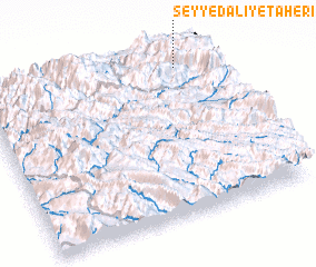 Places with similar names to Seyyed ‘Ālī-ye Ţāherī, Iran :: Disclaimer :: Information on this page comes without warranty of any kind |
||
|
Where is Seyyed ‘Ālī-ye Ţāherī? Elevation and coordinates ::
Latitude (lat): 31°55'8"N Longitude (lon): 50°51'52"E
Elevation (approx.): 2305m (map arrows pan, magnifying glasses zoom) |
||
|
Visiting Seyyed ‘Ālī-ye Ţāherī? Hotel/Accommodation ::
Book a hotel in Seyyed ‘Ālī-ye Ţāherī Travel Guide ::
Buy a travel guide for Iran rental cars ::
car rental offers GPS waypoint ::
download a GPX waypoint (PoI) of Seyyed ‘Ālī-ye Ţāherī for your GPS receiver
|
||