|
search place name
|
||
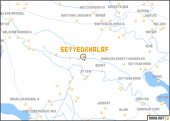
Seyyed Khalaf (Khūzestān, Iran)Seyyed Khalaf is a town in the Khūzestān region of Iran. An overview map of the region around Seyyed Khalaf is displayed below.
regional and 3d topo map of Seyyed Khalaf, Iran ::
Seyyed Khalaf airports ::
The nearest airport is AWZ - Ahwaz, located 76.1 km south east of Seyyed Khalaf.
Other airports nearby include QMJ - Masjed Soleiman Shahid Asyaee (77.6 km east), MRX - Bandar Mahshahr Mahshahr (170.4 km south east), BSR - Basrah Intl (174.5 km south west), ABD - Abadan (178.6 km south), Nearby towns ::
Mīān Āb (1.1km north west) //
Seyyed Khashān (1.4km west) //
Seyyed Raḩīmeh (2.9km west) //
‘Eyteh (3.6km south) //
Alāvī (4.1km south) //
Qūmāt (3.8km south east) //
Seyyed ‘Alī-ye Tehrānī (4.4km south west) //
Seyyed Moḩammad Bokhāt-e Halvān (5.5km south west) //
Sādāt-e Aḩmadī (5.6km west) //
Sadd-e Kheyrābād (6.7km south) //
Ḩājjī Hanow (6.7km south west) //
Bokheh Khomād (7.7km north east) //
Emāmzādeh Seyyed Ḩāchem (7.6km south west) //
Mollā Salmān-e Bandarī (8.3km south) //
Emāmzādeh Seyyed Moḩsen (7.3km east) //
Emāmzādeh Seyyed Moḩsen (7.3km east) //
Shahrak-e Shahīd Madanī (8.4km north east) //
Sheykh Şāleḩ Sā‘īd (8.4km north east) //
Najeh-ye Chārī (8.4km north east) //
Choghā Zanbīl (8.1km north east) //
Sheykh Khomāţ (8.1km north east) //
Sheykh ‘Alī Aşghar (9.0km north) //
Salmān Dāvūd (9.0km south) //
Ḩoseyn Ghalayem (8.7km south west) //
‘Ammār (9.4km north) //
Beyt-e Jeyrān (8.8km south east) //
‘Eynollāh Valī (9.1km north east) //
Nīm Īstgāh-e Āhū Dasht (9.4km south east) //
Najeh-ye Ḩoseyn (10.0km north east) //
[all distances 'as the bird flies' and approximate] 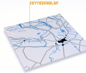 Places with similar names to Seyyed Khalaf, Iran ::
// Sayyid Khalaf (IQ)
// Seyyed Khalaf (IR)
// Sīdī Khalīfah (LY)
// Sidi Khalifa (DZ)
// Sidi Khalifa (DZ)
// Sidi Khelouaf (DZ)
Disclaimer :: Information on this page comes without warranty of any kind |
||
|
Where is Seyyed Khalaf? Elevation and coordinates ::
Latitude (lat): 31°58'13"N Longitude (lon): 48°27'1"E
Elevation (approx.): 42m (map arrows pan, magnifying glasses zoom) |
||
|
Visiting Seyyed Khalaf? Hotel/Accommodation ::
Book a hotel in Seyyed Khalaf Travel Guide ::
Buy a travel guide for Iran rental cars ::
car rental offers GPS waypoint ::
download a GPX waypoint (PoI) of Seyyed Khalaf for your GPS receiver
|
||