|
search place name
|
||
Seyyed Şāleḩ (Khūzestān, Iran)Seyyed Şāleḩ is a town in the Khūzestān region of Iran. An overview map of the region around Seyyed Şāleḩ is displayed below.
regional and 3d topo map of Seyyed Şāleḩ, Iran ::

Seyyed Şāleḩ airports ::
The nearest airport is AWZ - Ahwaz, located 51.0 km south east of Seyyed Şāleḩ.
Other airports nearby include QMJ - Masjed Soleiman Shahid Asyaee (73.8 km east), MRX - Bandar Mahshahr Mahshahr (145.3 km south east), ABD - Abadan (156.7 km south), BSR - Basrah Intl (158.3 km south west), Nearby towns ::
Feyāy (1.3km north) //
Seyyed Ḩoseyn (1.6km south west) //
Seyyed Zahrāb (2.0km south) //
Sheykh Jāsem (2.3km north west) //
Seyyed Ţāher (3.1km south) //
Beyt-e Seyyed ‘Alī (2.8km west) //
Seyyed Māshī (3.7km west) //
Seyyed Jāsem (4.3km south) //
Ḩānī (4.8km south) //
Mo'asseseh-ye Sheykh Jāber Ka‘b (4.9km south) //
Karīm Līāser (5.3km south west) //
Seyyed ‘Omeyr (5.1km north west) //
‘Abd ol Reẕā (5.9km south) //
Sheykh ‘Abūd (5.2km west) //
Mazra‘eh-ye Yek (6.1km north) //
‘Abd ol ‘Alī-ye Sayyāḩī (6.3km south) //
Seyyed Ḩasan (6.3km south) //
Albomāveh (6.5km south) //
Sheykh Fīā (6.6km south) //
Sheykh Jāber Ka‘b-e ‘Omeyr (5.8km west) //
Yāber (5.8km west) //
Eshāreh-ye Bozorg (6.6km south) //
Ka‘b-e ‘Omeyr (6.0km south west) //
Sheykh Zeydān (6.2km north west) //
Mazra‘eh-ye Sheykh Shāye‘ (7.2km north) //
‘Āshūr-e Amīrī (7.4km south) //
Barqeyẕeh (7.1km north west) //
Khasraj Khalaf (6.9km west) //
Saʼad (6.8km east) //
[all distances 'as the bird flies' and approximate] 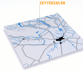 Places with similar names to Seyyed Şāleḩ, Iran ::
// Sidi Salah (MA)
// Sidi Salah (MA)
// Sitsali (MM)
// Zadział (PL)
// Zadziele (PL)
// Staicele (LV)
// Sayyid Şāliḩ (IQ)
// Sayyid Şāliḩ (IQ)
// Sayyid Şāliḩ (IQ)
// Sātsail (BD)
Disclaimer :: Information on this page comes without warranty of any kind |
||
|
Where is Seyyed Şāleḩ? Elevation and coordinates ::
Latitude (lat): 31°45'30"N Longitude (lon): 48°32'42"E
Elevation (approx.): 30m (map arrows pan, magnifying glasses zoom) |
||
|
Visiting Seyyed Şāleḩ? Hotel/Accommodation ::
Book a hotel in Seyyed Şāleḩ Travel Guide ::
Buy a travel guide for Iran rental cars ::
car rental offers GPS waypoint ::
download a GPX waypoint (PoI) of Seyyed Şāleḩ for your GPS receiver
|
||