|
search place name
|
||
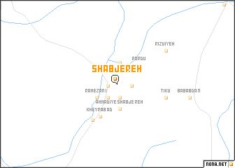
Sha‘b Jereh (Kermān, Iran)Sha‘b Jereh is a town in the Kermān region of Iran. An overview map of the region around Sha‘b Jereh is displayed below.
regional and 3d topo map of Sha‘b Jereh, Iran ::
Sha‘b Jereh airports ::
The nearest airport is KER - Kerman, located 109.1 km south east of Sha‘b Jereh.
Other airports nearby include AZD - Yazd Shahid Sadooghi (209.1 km north west), Nearby towns ::
Sheyvar (1.3km west) //
Deyū (2.2km south) //
Qal‘eh-ye Solţān Khalīfeh (2.0km east) //
Aḩmadī (2.5km south west) //
Moḩammadābād (3.4km north) //
Rameẕānī (3.5km south west) //
Nabīābād (3.5km south west) //
Aḩmadī-ye Sha‘b Jereh (4.0km south) //
Por Dū (4.3km north east) //
Kheyrābād (5.7km south west) //
Zeynalābād (6.7km south west) //
Tīkū (7.0km east) //
Rīzūʼīyeh (8.5km north east) //
[all distances 'as the bird flies' and approximate] 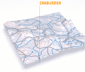 Places with similar names to Sha‘b Jereh, Iran ::
// Chāy Bījār (IR)
// Sīāh Bījār (IR)
Disclaimer :: Information on this page comes without warranty of any kind |
||
|
Where is Sha‘b Jereh? Elevation and coordinates ::
Latitude (lat): 31°2'9"N Longitude (lon): 56°13'47"E
Elevation (approx.): 1773m (map arrows pan, magnifying glasses zoom) |
||
|
Visiting Sha‘b Jereh? Hotel/Accommodation ::
Book a hotel in Sha‘b Jereh Travel Guide ::
Buy a travel guide for Iran rental cars ::
car rental offers GPS waypoint ::
download a GPX waypoint (PoI) of Sha‘b Jereh for your GPS receiver
|
||