|
search place name
|
||
Shāhīdar (Kordestān, Iran)Shāhīdar is a town in the Kordestān region of Iran. An overview map of the region around Shāhīdar is displayed below.
regional and 3d topo map of Shāhīdar, Iran ::

Shāhīdar airports ::
The nearest airport is SDG - Sanandaj, located 49.5 km south east of Shāhīdar.
Other airports nearby include KSH - Bakhtaran Shahid Ashrafi Esfahani (135.4 km south east), Nearby towns ::
Pīr Khezer Shāhū (3.5km south west) //
Chūʼīn (3.7km south) //
Mūlīnān (3.6km west) //
Bābā (4.4km north) //
Pīr Kheẕrān (4.3km south west) //
Sīvar (4.7km north) //
Varū (4.1km west) //
Halīzābād (4.4km south west) //
Pelyāndar (5.0km north west) //
Zenūrī (6.1km south east) //
Shāhīn (6.7km south) //
Khoshkīn-e Kūmāsī (6.7km south east) //
Vanīneh-ye ‘Olyā (6.7km north west) //
Jalīleh (7.8km north) //
Sūrkūl (7.7km south) //
Vanīneh-ye Soflá (6.7km north west) //
Lāvīsān (6.7km west) //
Sorkh Kūl (8.0km south) //
Polūreh (6.9km east) //
Hang-e Zhāleh (7.1km west) //
Sheykh ‘Aţţār (8.9km north west) //
Bīdarreh (9.6km south west) //
Ţāleh Varān (9.8km south east) //
Ḩasan Qareh (11.0km north west) //
[all distances 'as the bird flies' and approximate] 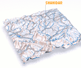 Places with similar names to Shāhīdar, Iran :: Disclaimer :: Information on this page comes without warranty of any kind |
||
|
Where is Shāhīdar? Elevation and coordinates ::
Latitude (lat): 35°26'58"N Longitude (lon): 46°31'29"E
Elevation (approx.): 1594m (map arrows pan, magnifying glasses zoom) |
||
|
Visiting Shāhīdar? Hotel/Accommodation ::
Book a hotel in Shāhīdar Travel Guide ::
Buy a travel guide for Iran rental cars ::
car rental offers GPS waypoint ::
download a GPX waypoint (PoI) of Shāhīdar for your GPS receiver
|
||