|
search place name
|
||
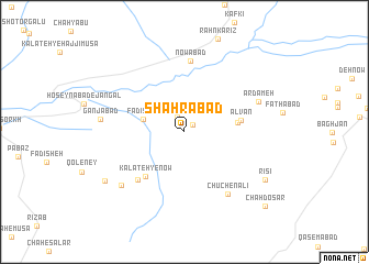
Shahrābād (Khorāsān, Iran)Shahrābād is a town in the Khorāsān region of Iran. An overview map of the region around Shahrābād is displayed below.
regional and 3d topo map of Shahrābād, Iran ::
Shahrābād airports ::
The nearest airport is ASB - Ashkhabad Ashgabat, located 219.6 km north of Shahrābād.
Nearby towns ::
Naz̧rābād (1.0km north east) //
Dastfeshād (1.6km north west) //
Fadīsheh (3.7km west) //
Naşrābād-e Pā'īn (4.5km east) //
Aḩmadābād (4.5km east) //
Alvān (4.8km east) //
Gol Qandasht (4.8km east) //
Kalāteh-ye Now (5.6km south west) //
Chāh-e Koroq (6.2km south west) //
Nowābād (7.2km north) //
Chūchen ‘Alī (7.3km south east) //
Ardameh (6.9km north east) //
Chāh-e Gavazn (7.5km south west) //
Ganjābād (7.1km west) //
Kalāteh-ye Bāgh (8.2km south west) //
Rīsī (8.3km south east) //
Chāh Do Sar (10.0km south east) //
[all distances 'as the bird flies' and approximate] 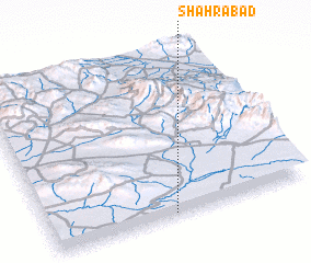 Places with similar names to Shahrābād, Iran ::
// Chārābād (IR)
// Chehrābād (IR)
// Cherāghābād (IR)
// Cherāghābād (IR)
// Cherāghābād (IR)
// Cherāghābād (IR)
// Cherāghābād (IR)
// Cherāghābād (IR)
// Cherāghābād (IR)
// Cherāghābād (IR)
Disclaimer :: Information on this page comes without warranty of any kind |
||
|
Where is Shahrābād? Elevation and coordinates ::
Latitude (lat): 36°0'38"N Longitude (lon): 58°28'33"E
Elevation (approx.): 1107m (map arrows pan, magnifying glasses zoom) |
||
|
Visiting Shahrābād? Hotel/Accommodation ::
Book a hotel in Shahrābād Travel Guide ::
Buy a travel guide for Iran rental cars ::
car rental offers GPS waypoint ::
download a GPX waypoint (PoI) of Shahrābād for your GPS receiver
|
||