|
search place name
|
||
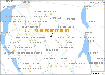
Shahrak-e ‘Edālat (Khūzestān, Iran)Shahrak-e ‘Edālat is a town in the Khūzestān region of Iran. An overview map of the region around Shahrak-e ‘Edālat is displayed below.
regional and 3d topo map of Shahrak-e ‘Edālat, Iran ::
Shahrak-e ‘Edālat airports ::
The nearest airport is QMJ - Masjed Soleiman Shahid Asyaee, located 79.7 km east of Shahrak-e ‘Edālat.
Other airports nearby include AWZ - Ahwaz (107.1 km south), MRX - Bandar Mahshahr Mahshahr (200.7 km south), BSR - Basrah Intl (206.8 km south), ABD - Abadan (212.5 km south), Nearby towns ::
Chūghā Sūrkī (1.1km north west) //
Shalgahī-ye Pāʼīn (1.4km south east) //
Choghā Shīr (2.2km south west) //
Choghā Sorkh (2.2km south west) //
Shahrak-e Shahīd Karīmī (2.5km south east) //
Mashhadī Moḩammad (3.5km north west) //
Shāhābād (3.7km north east) //
Shalgehī-ye Pā'īn (3.8km south east) //
Eslāmābād (3.9km north east) //
Qal‘eh-ye Sardār (4.3km east) //
Shahrak-e Shamsābād (4.6km north west) //
Boneh-ye Mashhad Moḩammad (4.6km north west) //
Boneh-ye Ḩāj ‘Abd ol Moḩammad (4.6km north west) //
Benūt-e Bālā (5.3km south) //
Shāh ‘Abd ol Qāsem (5.1km north east) //
Sīāh Manşūr (6.1km north) //
Kheyrābād (5.2km west) //
Qal‘eh-ye Khākestarī (5.2km west) //
Qal‘eh-ye Qāẕī (5.2km west) //
Qal‘eh-ye Now Bīsheh (5.3km west) //
Bonvār-e Shāmī (5.9km north west) //
Benūt-e Pāʼīn (6.4km south) //
Bayātīyūn-e Āşef Khān (6.5km south) //
Najafābād (5.8km south west) //
Shahrak-e Towḩīd (5.9km north west) //
Qal‘eh-ye Khalīl (6.2km south east) //
Bayātīān-e Aşef Khān (6.7km south) //
Fozeylī (6.4km south east) //
Qal‘eh Now Shamsābād (7.0km north west) //
[all distances 'as the bird flies' and approximate]  Places with similar names to Shahrak-e ‘Edālat, Iran :: Disclaimer :: Information on this page comes without warranty of any kind |
||
|
Where is Shahrak-e ‘Edālat? Elevation and coordinates ::
Latitude (lat): 32°16'28"N Longitude (lon): 48°29'18"E
Elevation (approx.): 88m (map arrows pan, magnifying glasses zoom) |
||
|
Visiting Shahrak-e ‘Edālat? Hotel/Accommodation ::
Book a hotel in Shahrak-e ‘Edālat Travel Guide ::
Buy a travel guide for Iran rental cars ::
car rental offers GPS waypoint ::
download a GPX waypoint (PoI) of Shahrak-e ‘Edālat for your GPS receiver
|
||