|
search place name
|
||
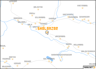
Shalamzār (Chahār Maḩāll va Bakhtīār, Iran)Shalamzār is a town in the Chahār Maḩāll va Bakhtīār region of Iran. An overview map of the region around Shalamzār is displayed below.
regional and 3d topo map of Shalamzār, Iran ::
Shalamzār airports ::
The nearest airport is QMJ - Masjed Soleiman Shahid Asyaee, located 145.9 km west of Shalamzār.
Other airports nearby include MRX - Bandar Mahshahr Mahshahr (228.6 km south west), Nearby towns ::
Kamar Sīāh (2.9km north west) //
Teshnīz (3.6km north west) //
Ja‘farābād (4.4km east) //
Dastnā' (4.4km north west) //
Kharājī (5.5km north) //
Shāpūrābād (5.4km north west) //
Eslāmābād (6.3km north west) //
Amīrābād (5.9km north west) //
Salm (6.6km north west) //
Gahrū (8.3km south east) //
Gahrū (8.3km south east) //
Parūj (9.0km north west) //
Shahrak-e Zeverdegān (9.8km south east) //
Sarteshnīz (9.6km north east) //
[all distances 'as the bird flies' and approximate] 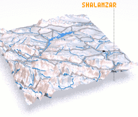 Places with similar names to Shalamzār, Iran ::
// Chelmozero (RU)
// Chilmozero (RU)
// Chalmeh Sarā (IR)
// Chala-Mazar (UZ)
// Chillamazar (UZ)
// Shelamzār (IR)
// Chillamazor (TJ)
Disclaimer :: Information on this page comes without warranty of any kind |
||
|
Where is Shalamzār? Elevation and coordinates ::
Latitude (lat): 32°2'38"N Longitude (lon): 50°48'50"E
Elevation (approx.): 2018m (map arrows pan, magnifying glasses zoom) |
||
|
Visiting Shalamzār? Hotel/Accommodation ::
Book a hotel in Shalamzār Travel Guide ::
Buy a travel guide for Iran rental cars ::
car rental offers GPS waypoint ::
download a GPX waypoint (PoI) of Shalamzār for your GPS receiver
|
||