|
search place name
|
||
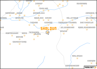
Shālqūn (Kermān, Iran)Shālqūn is a town in the Kermān region of Iran. An overview map of the region around Shālqūn is displayed below.
regional and 3d topo map of Shālqūn, Iran ::
Shālqūn airports ::
The nearest airport is TBZ - Tabriz Intl, located 126.4 km west of Shālqūn.
Other airports nearby include RAS - Rasht (184.0 km east), Nearby towns ::
Kūshnaq (3.7km north) //
Bījand (3.3km west) //
Mehīn (4.4km west) //
Tāzeh Kand (4.4km west) //
Hīrvān (5.6km north) //
Eydarshān (4.8km south west) //
Dūnīq (5.7km north) //
Ardehā (4.7km east) //
Tīrshāb (5.7km north west) //
Āq Dālākh (6.3km north west) //
Jeldeh Bākhān (6.1km east) //
Ḩasanjān (7.1km north east) //
Tappeh Seyyedābād (6.9km north east) //
Qarā Dālākh (8.0km north) //
Hūlīq (6.9km north west) //
[all distances 'as the bird flies' and approximate]  Places with similar names to Shālqūn, Iran ::
Disclaimer :: Information on this page comes without warranty of any kind |
||
|
Where is Shālqūn? Elevation and coordinates ::
Latitude (lat): 37°49'0"N Longitude (lon): 47°37'0"E
Elevation (approx.): 1758m (map arrows pan, magnifying glasses zoom) |
||
|
Visiting Shālqūn? Hotel/Accommodation ::
Book a hotel in Shālqūn Travel Guide ::
Buy a travel guide for Iran rental cars ::
car rental offers GPS waypoint ::
download a GPX waypoint (PoI) of Shālqūn for your GPS receiver
|
||