|
search place name
|
||
Sharī Marī (Khūzestān, Iran)Sharī Marī is a town in the Khūzestān region of Iran. An overview map of the region around Sharī Marī is displayed below.
regional and 3d topo map of Sharī Marī, Iran ::

Sharī Marī airports ::
The nearest airport is AWZ - Ahwaz, located 28.8 km south of Sharī Marī.
Other airports nearby include QMJ - Masjed Soleiman Shahid Asyaee (60.1 km north east), MRX - Bandar Mahshahr Mahshahr (116.5 km south), ABD - Abadan (147.4 km south west), BSR - Basrah Intl (162.5 km south west), Nearby towns ::
Būḩer (0.7km south) //
Mazra‘eh-ye Sheykh Karīm (1.6km north) //
Sheykh Kāz̧em (1.5km south west) //
Mollā S̄ānī (1.6km north east) //
Vahābī (2.8km north) //
‘Abbāsīyeh (3.4km south) //
Ḩamīd (3.4km north) //
Naddāfīyeh (3.7km north) //
Mo'asseseh-ye Ḩājjī Ḩamū (4.0km south east) //
Ḩelleh va Delleh (4.9km south) //
Mo'asseseh-ye Ḩājjī Khān Dūstī (4.9km south) //
Darāvīzeh-ye Do (5.1km north) //
Yekāvīyeh-ye Do (5.1km north west) //
Mo'asseseh-ye Farīhī (5.2km west) //
‘Anāfjeh (5.6km north west) //
Qal‘eh-ye Shomeyl (5.2km west) //
Sorkheh-ye Yek (5.2km west) //
Sorkheh-ye Do (5.5km south west) //
Yekāvīyeh-ye Yek (5.7km north west) //
Alā Khūyeh (5.4km west) //
Sheykh‘alī (5.8km north east) //
Yekāvīyeh-ye Seh (5.5km west) //
Asbaʼ (5.5km west) //
Ḩājjī Naşrollāh (5.7km south west) //
Shamātgar (6.4km north) //
Şoley‘eh (5.8km north east) //
Şoley‘eh (5.8km north east) //
Cham Khazām-e Do (6.5km north west) //
Darāvīzeh-ye Yek (6.5km north east) //
[all distances 'as the bird flies' and approximate] 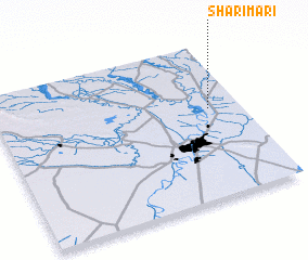 Places with similar names to Sharī Marī, Iran ::
// Ciaramira (IT)
// Shīramar (IQ)
// Shīrāmar (IQ)
// Charmar (US)
// Chaurimora (BD)
// Shārmāra (BD)
// Charmuria (IN)
// Chirmira (IN)
// Charamoray (PE)
// Churamaray (PE)
Disclaimer :: Information on this page comes without warranty of any kind |
||
|
Where is Sharī Marī? Elevation and coordinates ::
Latitude (lat): 31°34'46"N Longitude (lon): 48°52'23"E
Elevation (approx.): 26m (map arrows pan, magnifying glasses zoom) |
||
|
Visiting Sharī Marī? Hotel/Accommodation ::
Book a hotel in Sharī Marī Travel Guide ::
Buy a travel guide for Iran rental cars ::
car rental offers GPS waypoint ::
download a GPX waypoint (PoI) of Sharī Marī for your GPS receiver
|
||