|
search place name
|
||
Sherkat-e Sīmorgh (Iran)Sherkat-e Sīmorgh is a town in Iran. An overview map of the region around Sherkat-e Sīmorgh is displayed below.
regional and 3d topo map of Sherkat-e Sīmorgh, Iran ::

Sherkat-e Sīmorgh airports ::
The nearest airport is THR - Teheran Mehrabad Intl, located 113.6 km east of Sherkat-e Sīmorgh.
Other airports nearby include RZR - Ramsar (124.2 km north east), RAS - Rasht (163.8 km north), Nearby towns ::
Qeshlāq-e Morānlū (1.9km north) //
Ne‘matābād (3.7km north) //
Kharīdār-e Sang (3.0km east) //
Amīrābād-e Kohneh (4.8km south west) //
Bolūk-e Zahrā (4.8km north east) //
Seyfābād (4.9km east) //
Qal‘eh-ye Qodrat (4.9km west) //
‘Eşmatābād (6.6km south) //
Sherkat-e Taraqqī (6.3km north east) //
Morghdārī (7.4km north) //
Pāpolī-ye Mīānī (7.1km north east) //
Khorramābād (6.3km west) //
Karīmābād (7.1km south west) //
Qeshlāq-e ‘Āsheq Bahārī (8.2km north west) //
Moshkīn Tappeh (8.7km south west) //
Pāpolī-ye Bālā (8.7km north west) //
Meshgīn Tappeh (8.7km south west) //
[all distances 'as the bird flies' and approximate] 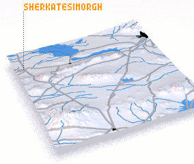 Places with similar names to Sherkat-e Sīmorgh, Iran :: Disclaimer :: Information on this page comes without warranty of any kind |
||
|
Where is Sherkat-e Sīmorgh? Elevation and coordinates ::
Latitude (lat): 35°54'0"N Longitude (lon): 50°5'0"E
Elevation (approx.): 1175m (map arrows pan, magnifying glasses zoom) |
||
|
Visiting Sherkat-e Sīmorgh? Hotel/Accommodation ::
Book a hotel in Sherkat-e Sīmorgh Travel Guide ::
Buy a travel guide for Iran rental cars ::
car rental offers GPS waypoint ::
download a GPX waypoint (PoI) of Sherkat-e Sīmorgh for your GPS receiver
|
||