|
search place name
|
||
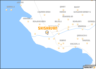
Shīshavān (Ostān-e Āz̄arbāyjān-e Gharbī, Iran)Shīshavān is a town in the Ostān-e Āz̄arbāyjān-e Gharbī region of Iran. An overview map of the region around Shīshavān is displayed below.
regional and 3d topo map of Shīshavān, Iran ::
Shīshavān airports ::
The nearest airport is TBZ - Tabriz Intl, located 80.6 km north east of Shīshavān.
Nearby towns ::
Mehrābād (1.6km south) //
Heravān (1.6km south) //
Shahrak-e Mīlād (2.4km north west) //
Gowravān (2.4km south east) //
Tāzeh Kand (2.8km north east) //
‘Ajab Shīr (3.2km north east) //
Gol Tappeh (3.3km east) //
Dānālū (4.1km west) //
Āghjeh Owbeh (4.7km north west) //
Nānesā' (4.8km south east) //
Būlālū (5.1km north east) //
Shīrāz (5.6km south east) //
Posyān (6.2km south east) //
Nebrīn (5.9km south east) //
Kharājū (6.7km north east) //
Chūpānkareh (7.7km north) //
Rāzīān (7.1km south east) //
Maḩmūdābād (6.6km east) //
Alenjaq (6.6km east) //
Varīnjeq (6.6km east) //
Khānīān (7.0km north east) //
Raḩmānlū (8.0km north west) //
Mīāneh (9.0km north east) //
Mehmāndār (8.5km north east) //
[all distances 'as the bird flies' and approximate] 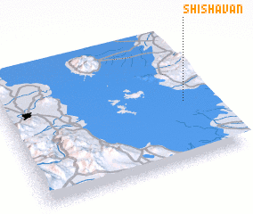 Places with similar names to Shīshavān, Iran ::
// Cheshevān (IR)
// Cheshaven (US)
// Chichavane (MZ)
// Chichavane (MZ)
// Ch'i-shih-fen (TW)
// Shih-chiu-fen (TW)
// Shih-chiu-fen (TW)
Disclaimer :: Information on this page comes without warranty of any kind |
||
|
Where is Shīshavān? Elevation and coordinates ::
Latitude (lat): 37°27'52"N Longitude (lon): 45°52'46"E
Elevation (approx.): 1284m (map arrows pan, magnifying glasses zoom) |
||
|
Visiting Shīshavān? Hotel/Accommodation ::
Book a hotel in Shīshavān Travel Guide ::
Buy a travel guide for Iran rental cars ::
car rental offers GPS waypoint ::
download a GPX waypoint (PoI) of Shīshavān for your GPS receiver
|
||