|
search place name
|
||
Shotor Khoft (Lorestān, Iran)Shotor Khoft is a town in the Lorestān region of Iran. An overview map of the region around Shotor Khoft is displayed below.
regional and 3d topo map of Shotor Khoft, Iran ::

Shotor Khoft airports ::
The nearest airport is KSH - Bakhtaran Shahid Ashrafi Esfahani, located 86.4 km west of Shotor Khoft.
Other airports nearby include SDG - Sanandaj (159.3 km north west), Nearby towns ::
Allāh Karam (1.5km south west) //
Kafrāj (1.8km north east) //
‘Azīzābād (2.1km north west) //
Solţānābād (2.4km north) //
Bahrām Shāh (2.2km south west) //
Sarāb-e Dāvūd (2.7km south east) //
Doāb-e Zālī (2.4km north west) //
Sarāb Ghaẕanfar (2.9km north) //
‘Azīzābād (2.7km west) //
Dehnow (3.0km east) //
Choqā Kabūd (3.3km north east) //
Deh Now (3.3km north west) //
Ḩoseyn Ţalaʼī (3.5km north east) //
Deh Forūzvand-e Soflá (3.7km north west) //
Sālīāneh (3.5km east) //
Esmā'īlābād (3.9km south west) //
Kaleh Jūb (3.7km east) //
Zamāneh (3.7km east) //
Yūrqolī (3.7km east) //
‘Azīzābād-e Soflá (3.7km west) //
Sharīf (4.2km south east) //
Karamelāhī (4.0km east) //
Sālārābād (4.4km north east) //
Gāv Bāzeh (4.4km north east) //
Ḩoseynābād-e Morādābād (4.6km south west) //
Teymūrābād (5.2km north west) //
Deh Forūzvand-e Vostá (5.2km north west) //
Akbarābād (5.4km south west) //
Fīrūzmand (5.6km north west) //
[all distances 'as the bird flies' and approximate] 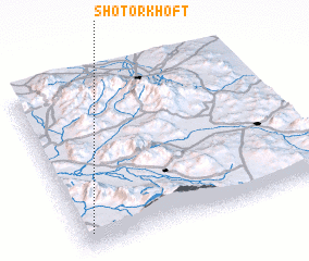 Places with similar names to Shotor Khoft, Iran :: Disclaimer :: Information on this page comes without warranty of any kind |
||
|
Where is Shotor Khoft? Elevation and coordinates ::
Latitude (lat): 34°5'35"N Longitude (lon): 48°2'41"E
Elevation (approx.): 1806m (map arrows pan, magnifying glasses zoom) |
||
|
Visiting Shotor Khoft? Hotel/Accommodation ::
Book a hotel in Shotor Khoft Travel Guide ::
Buy a travel guide for Iran rental cars ::
car rental offers GPS waypoint ::
download a GPX waypoint (PoI) of Shotor Khoft for your GPS receiver
|
||