|
search place name
|
||
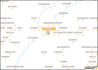
Shūrāb (Gīlān, Iran)Shūrāb is a town in the Gīlān region of Iran. An overview map of the region around Shūrāb is displayed below.
regional and 3d topo map of Shūrāb, Iran ::
Shūrāb airports ::
The nearest airport is RAS - Rasht, located 55.3 km north east of Shūrāb.
Other airports nearby include RZR - Ramsar (127.4 km east), Nearby towns ::
Arsīneh (1.5km east) //
Gargar (1.5km east) //
Khaldasht (1.5km west) //
Lāteh Berahneh (1.5km east) //
Sestān (2.4km north east) //
Garmāb Cheshmeh (2.4km north east) //
Ţālesh Del (3.0km east) //
Kūh-e Nahr Āb (3.7km north) //
Kaleh Setān (3.5km north west) //
Sardīār (3.5km north east) //
Kharkesh (4.0km north) //
Kaleh Chān (4.7km north east) //
Kaleh Chān (4.7km north east) //
Sūrkām (4.7km north east) //
Mīān Dīār (4.8km north east) //
Amīr Sar (4.8km north west) //
Dīār Darreh (4.8km north east) //
Jeyshābād (5.3km west) //
Yāl Zamān (5.9km east) //
Kelās (7.6km south) //
Sūteh (7.1km north west) //
Bālā Kabateh (7.1km south east) //
Kabateh (8.0km south) //
Ardangāh (8.6km north east) //
Kabateh (8.8km south east) //
[all distances 'as the bird flies' and approximate] 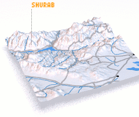 Places with similar names to Shūrāb, Iran ::
Disclaimer :: Information on this page comes without warranty of any kind |
||
|
Where is Shūrāb? Elevation and coordinates ::
Latitude (lat): 36°55'0"N Longitude (lon): 49°15'0"E
Elevation (approx.): 1760m (map arrows pan, magnifying glasses zoom) |
||
|
Visiting Shūrāb? Hotel/Accommodation ::
Book a hotel in Shūrāb Travel Guide ::
Buy a travel guide for Iran rental cars ::
car rental offers GPS waypoint ::
download a GPX waypoint (PoI) of Shūrāb for your GPS receiver
|
||