|
search place name
|
||
Shūrābeh (Lorestān, Iran)Shūrābeh is a town in the Lorestān region of Iran. An overview map of the region around Shūrābeh is displayed below.
regional and 3d topo map of Shūrābeh, Iran ::

Shūrābeh airports ::
The nearest airport is KSH - Bakhtaran Shahid Ashrafi Esfahani, located 128.7 km north west of Shūrābeh.
Other airports nearby include QMJ - Masjed Soleiman Shahid Asyaee (198.7 km south east), SDG - Sanandaj (218.2 km north west), Nearby towns ::
Raḩīmābād-e Yek (0.9km north west) //
Chelkash (1.2km south west) //
Kerfeleh-ye ‘Olyā (1.2km south west) //
Ja‘farābād (1.2km south west) //
Naqāreh-ye Nāveh Kesh (2.0km south) //
Raḩīmī (1.9km north east) //
Sarāb-e Nāveh Kesh (2.7km north) //
Sānbodān (2.8km north) //
Karfaleh-ye ‘Olyā (2.9km south west) //
Kerfeleh-ye Lāvand (3.0km south) //
Kerfeleh-ye Īmānābād (3.0km south) //
Qal‘eh-ye Nāveh Kesh (3.0km south) //
Cham-e Vazīr (3.0km south) //
Chahār Gūsh (3.4km south) //
Tāyāb (3.4km south east) //
Zahrā Kār-e Nesādeleh (3.6km south west) //
Zahrā Kār-e Veysīyān (3.6km south west) //
Lajām Gīr (3.6km south west) //
Darreh Sākī (3.6km north east) //
Bostān Rūd-e Soflá (3.7km south east) //
Posht-e Tang-e Chenār (4.2km south) //
Benrūteleh (4.8km south) //
Meleh Shabānān-e Seh (4.1km east) //
Garshīd Khān-e Yek (5.1km north east) //
Meleh Shabānān-e Do (4.8km north east) //
Shūrāb-e Ţāleqānī (5.4km south east) //
Meleh-ye Shabānān (5.3km east) //
Ḩātamī (5.9km north east) //
Shūrāb-e Soflá (6.0km south east) //
[all distances 'as the bird flies' and approximate] 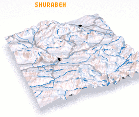 Places with similar names to Shūrābeh, Iran ::
Disclaimer :: Information on this page comes without warranty of any kind |
||
|
Where is Shūrābeh? Elevation and coordinates ::
Latitude (lat): 33°30'34"N Longitude (lon): 48°7'24"E
Elevation (approx.): 1134m (map arrows pan, magnifying glasses zoom) |
||
|
Visiting Shūrābeh? Hotel/Accommodation ::
Book a hotel in Shūrābeh Travel Guide ::
Buy a travel guide for Iran rental cars ::
car rental offers GPS waypoint ::
download a GPX waypoint (PoI) of Shūrābeh for your GPS receiver
|
||