|
search place name
|
||
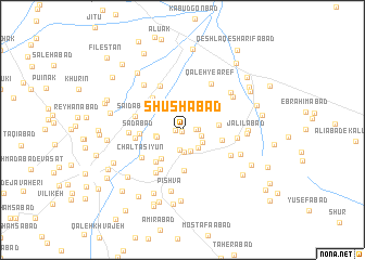
Shūshābād (Tehrān, Iran)Shūshābād is a town in the Tehrān region of Iran. An overview map of the region around Shūshābād is displayed below.
regional and 3d topo map of Shūshābād, Iran ::
Shūshābād airports ::
The nearest airport is THR - Teheran Mehrabad Intl, located 52.5 km north west of Shūshābād.
Other airports nearby include RZR - Ramsar (195.9 km north west), Nearby towns ::
Sūshābād (0.1km south) //
Ţārand-e ‘Olyā (0.6km west) //
Qū'īnak-e Rakhshānī (1.2km east) //
‘Alīābād-e Zavāreh Bīd (1.3km east) //
Zavāreh Bīd (1.7km east) //
Qal‘eh Shūrān (2.1km south) //
Shūrān (2.3km south) //
Qeshlāq-e Ganjī (2.3km south) //
‘Alīābād-e Ahīyeh (2.2km south east) //
Şāleḩābād (2.2km south east) //
Āhīyeh (2.1km south east) //
Sho‘eybābād (2.2km west) //
Ţārand-e Soflá (2.3km west) //
Qal‘eh-ye Ḩoseyn (3.4km south west) //
Jāmeh Kārān (3.1km east) //
Chāleh Omīd (4.2km south) //
Qal‘eh Now (3.5km east) //
Qāsemābād (4.0km south west) //
Emamzādeh Chehel Khātūn (4.1km north west) //
Sa‘dābād (3.7km west) //
Esmā‘īlābād (4.5km south west) //
Yūsef Reẕā (4.0km west) //
Sa‘īdābād (4.2km west) //
Chāltāsīyūn (4.5km south west) //
Jamālābād (4.9km north) //
Ḩabībābād (4.9km south west) //
Qal‘eh Cheh (4.5km west) //
Qal‘eh-ye ‘Āref (5.3km north east) //
Shahrak-e Ghīās̄ābād (4.9km south east) //
[all distances 'as the bird flies' and approximate] 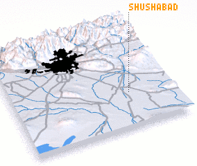 Places with similar names to Shūshābād, Iran ::
Disclaimer :: Information on this page comes without warranty of any kind |
||
|
Where is Shūshābād? Elevation and coordinates ::
Latitude (lat): 35°21'58"N Longitude (lon): 51°44'9"E
Elevation (approx.): 974m (map arrows pan, magnifying glasses zoom) |
||
|
Visiting Shūshābād? Hotel/Accommodation ::
Book a hotel in Shūshābād Travel Guide ::
Buy a travel guide for Iran rental cars ::
car rental offers GPS waypoint ::
download a GPX waypoint (PoI) of Shūshābād for your GPS receiver
|
||