|
search place name
|
||
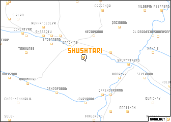
Shūshtarī (Kordestān, Iran)Shūshtarī is a town in the Kordestān region of Iran. An overview map of the region around Shūshtarī is displayed below.
regional and 3d topo map of Shūshtarī, Iran ::
Shūshtarī airports ::
The nearest airport is SDG - Sanandaj, located 81.9 km south west of Shūshtarī.
Other airports nearby include KSH - Bakhtaran Shahid Ashrafi Esfahani (156.2 km south), RAS - Rasht (248.0 km north east), Nearby towns ::
Dār Ghīās̄ (4.2km north west) //
Bābā Rashānī (4.9km east) //
Hezār Khān (5.8km north) //
Qezel Āghāj (7.2km north west) //
Gowjeh Kand (8.0km south) //
Bāqerābād (7.1km north west) //
Konāmār (7.1km south east) //
Qareh Darband (8.7km south east) //
Cheshmeh Ādīneh (8.2km north west) //
Ashrafābād (8.6km south west) //
Qāẕīābād (9.5km north east) //
[all distances 'as the bird flies' and approximate] 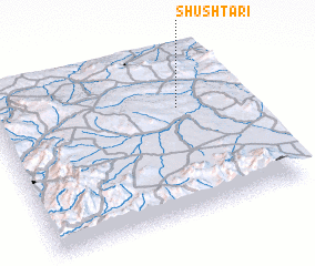 Places with similar names to Shūshtarī, Iran ::
// Shchadyr (KZ)
// Shūshtar (IR)
// Shūshtarī (IR)
// Douar Chachea (DZ)
// Douar Chouachia (DZ)
// Shchedra (RU)
Disclaimer :: Information on this page comes without warranty of any kind |
||
|
Where is Shūshtarī? Elevation and coordinates ::
Latitude (lat): 35°40'0"N Longitude (lon): 47°45'0"E
Elevation (approx.): 1748m (map arrows pan, magnifying glasses zoom) |
||
|
Visiting Shūshtarī? Hotel/Accommodation ::
Book a hotel in Shūshtarī Travel Guide ::
Buy a travel guide for Iran rental cars ::
car rental offers GPS waypoint ::
download a GPX waypoint (PoI) of Shūshtarī for your GPS receiver
|
||