|
search place name
|
||
Sīr Dotūj (Hormozgān, Iran)Sīr Dotūj is a town in the Hormozgān region of Iran. An overview map of the region around Sīr Dotūj is displayed below.
regional and 3d topo map of Sīr Dotūj, Iran ::

Sīr Dotūj airports ::
The nearest airport is BND - Bandar Abbass Intl, located 30.7 km south west of Sīr Dotūj.
Other airports nearby include KHS - Khasab (136.7 km south), BDH - Bandar Lengeh (202.7 km south west), RKT - Ras Al Khaimah Intl (205.0 km south), Nearby towns ::
Lardū (0.8km east) //
Sarchīl Jalābī (1.8km south east) //
Chāh Fa‘leh (2.0km north west) //
Sarjīn (2.0km south east) //
Maḩmūd Kalāghī (2.8km north east) //
Tūj (3.1km east) //
Madong-e Aḩmad (3.2km west) //
Jalābī (3.6km east) //
Nowbast (4.0km south east) //
Rīgū (4.0km east) //
Chāh Barrā (4.3km west) //
Bārīz (5.3km south) //
Poshteh-ye Seyyedān (6.0km north) //
Kohūr Kalāghī (6.6km north east) //
Ţāherī (7.0km south east) //
Shāh ‘Avazī (7.3km north) //
Poshtkūh (7.3km east) //
Bodok (8.8km north) //
Bābā ‘Ālem-e Pā'īn (8.8km south) //
[all distances 'as the bird flies' and approximate] 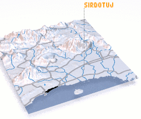 Places with similar names to Sīr Dotūj, Iran ::
// Sératodji (ML)
Disclaimer :: Information on this page comes without warranty of any kind |
||
|
Where is Sīr Dotūj? Elevation and coordinates ::
Latitude (lat): 27°20'55"N Longitude (lon): 56°39'7"E
Elevation (approx.): 18m (map arrows pan, magnifying glasses zoom) |
||
|
Visiting Sīr Dotūj? Hotel/Accommodation ::
Book a hotel in Sīr Dotūj Travel Guide ::
Buy a travel guide for Iran rental cars ::
car rental offers GPS waypoint ::
download a GPX waypoint (PoI) of Sīr Dotūj for your GPS receiver
|
||