|
search place name
|
||
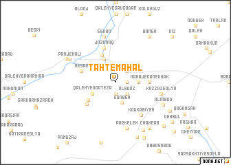
Taḩt-e Maḩal (Iran)Taḩt-e Maḩal is a town in Iran. An overview map of the region around Taḩt-e Maḩal is displayed below.
regional and 3d topo map of Taḩt-e Maḩal, Iran ::
Taḩt-e Maḩal airports ::
The nearest airport is THR - Teheran Mehrabad Intl, located 257.1 km north east of Taḩt-e Maḩal.
Nearby towns ::
Ḩomrīān (1.5km east) //
Mahājerān-e Mollā Abol Ḩasan (1.5km east) //
Ḩak-e Soflá (1.9km south) //
Ḩak-e ‘Olyā (1.9km south) //
Ḩasanābād (2.4km north east) //
Alborz (2.4km south east) //
Donbeh (3.4km south) //
Mahājerān-e Kamar (3.1km east) //
Ḩoseynābād (4.0km north west) //
Mehdīābād (4.0km north west) //
Qal‘eh-ye Morteẕá (3.6km south west) //
Far (4.7km north) //
Darreh Şāleḩān (4.7km south west) //
Mahājerān-e Khāk (4.6km east) //
Ḩeşār (5.2km south west) //
Ḩeşār (5.0km west) //
Jazanaq (5.8km north) //
Kowkabīyeh (6.4km south east) //
Kazzāz-e Soflá (6.4km east) //
Eskān (7.6km north) //
Kazzāz-e ‘Olyā (6.4km east) //
Parkeleh (7.6km south) //
Panjeh ‘Alī (7.2km north west) //
‘Alīābād (7.4km south east) //
Tūreh (7.6km north west) //
Kalāveh (8.7km south east) //
Bāneh (8.7km north east) //
Chāh-e Āb (8.7km south east) //
Akbarābād (9.7km south east) //
[all distances 'as the bird flies' and approximate]  Places with similar names to Taḩt-e Maḩal, Iran ::
// Dūd Maḩalleh (IR)
// Dadu Mahal (IN)
Disclaimer :: Information on this page comes without warranty of any kind |
||
|
Where is Taḩt-e Maḩal? Elevation and coordinates ::
Latitude (lat): 34°1'0"N Longitude (lon): 49°22'0"E
Elevation (approx.): 1846m (map arrows pan, magnifying glasses zoom) |
||
|
Visiting Taḩt-e Maḩal? Hotel/Accommodation ::
Book a hotel in Taḩt-e Maḩal Travel Guide ::
Buy a travel guide for Iran rental cars ::
car rental offers GPS waypoint ::
download a GPX waypoint (PoI) of Taḩt-e Maḩal for your GPS receiver
|
||