|
search place name
|
||
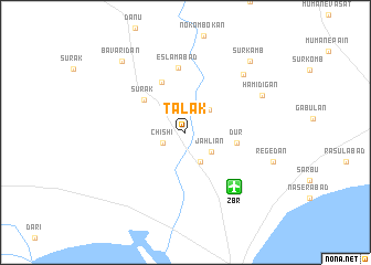
Talak (Sīstān va Balūchestān, Iran)Talak is a town in the Sīstān va Balūchestān region of Iran. An overview map of the region around Talak is displayed below.
regional and 3d topo map of Talak, Iran ::
Talak airports ::
The nearest airport is ZBR - Chah Bahar, located 7.2 km south east of Talak.
Other airports nearby include GWD - Gwadar (202.6 km east), Nearby towns ::
Chīshī (2.3km south west) //
Jahlīān (3.0km south east) //
Sergān-e Lāgharī (3.1km north east) //
Sergān (3.2km south east) //
Dūr (4.8km east) //
Sūrak (5.0km north west) //
Bānsont (5.5km north) //
Eslāmābād (6.6km north) //
Cherāghābād (7.9km north east) //
Ḩamīdī Gān (7.9km north east) //
Regedān (8.5km east) //
Bāvarīdān (9.3km north west) //
Sūr Kamb (9.3km north east) //
[all distances 'as the bird flies' and approximate] 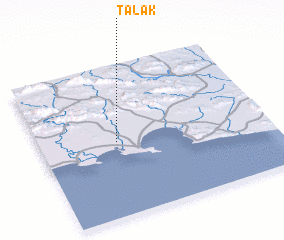 Places with similar names to Talak, Iran ::
Disclaimer :: Information on this page comes without warranty of any kind |
||
|
Where is Talak? Elevation and coordinates ::
Latitude (lat): 25°29'36"N Longitude (lon): 60°20'13"E
Elevation (approx.): 11m (map arrows pan, magnifying glasses zoom) |
||
|
Visiting Talak? Hotel/Accommodation ::
Book a hotel in Talak Travel Guide ::
Buy a travel guide for Iran rental cars ::
car rental offers GPS waypoint ::
download a GPX waypoint (PoI) of Talak for your GPS receiver
|
||