|
search place name
|
||
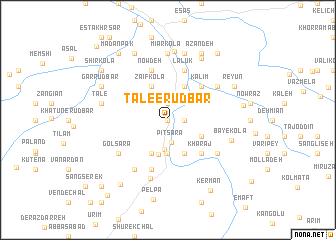
Ţāle‘-e Rūdbār (Iran)Ţāle‘-e Rūdbār is a town in Iran. An overview map of the region around Ţāle‘-e Rūdbār is displayed below.
regional and 3d topo map of Ţāle‘-e Rūdbār, Iran ::
Ţāle‘-e Rūdbār airports ::
The nearest airport is THR - Teheran Mehrabad Intl, located 161.9 km west of Ţāle‘-e Rūdbār.
Nearby towns ::
Aleban (0.0km north) //
Bāghmal (0.0km north) //
Ţāle‘-e Pā'īn (1.9km north) //
Cham Cham (1.5km east) //
Valeh-ye Rūdbār (1.5km east) //
Pīt Sarā (2.6km south) //
Bālā Do Āb (3.3km south) //
Pā'īn Do Āb (3.7km south) //
Padegān-e Do Āb (3.7km south) //
Sīmet (3.9km south) //
Pol-e Kalāntarī (4.0km south) //
Samīt (4.0km south) //
Sar Chaleshk (4.0km south) //
Ḩājjī Kolā (4.0km north) //
Ẕa‘īf Kolā (4.0km north) //
Sar Khol (3.5km south east) //
Shūr Mast (4.0km north) //
Kharaj (4.8km south east) //
Kālīm (4.8km north east) //
Khvosh Darreh (4.8km north east) //
Zāl Darreh (5.8km south) //
Now Deh (5.8km north) //
Kelach Khvāstān (5.8km north) //
Lalūk (5.8km north) //
Sang Sar (5.8km north) //
Gol Sarā (5.8km south west) //
Takht-e Marmar (6.3km south west) //
Kherej (5.8km south east) //
Lamzer (5.8km north east) //
[all distances 'as the bird flies' and approximate] 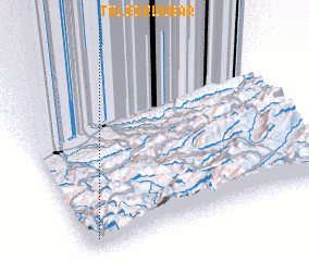 Places with similar names to Ţāle‘-e Rūdbār, Iran :: Disclaimer :: Information on this page comes without warranty of any kind |
||
|
Where is Ţāle‘-e Rūdbār? Elevation and coordinates ::
Latitude (lat): 36°3'0"N Longitude (lon): 53°3'0"E
Elevation (approx.): 850m (map arrows pan, magnifying glasses zoom) |
||
|
Visiting Ţāle‘-e Rūdbār? Hotel/Accommodation ::
Book a hotel in Ţāle‘-e Rūdbār Travel Guide ::
Buy a travel guide for Iran rental cars ::
car rental offers GPS waypoint ::
download a GPX waypoint (PoI) of Ţāle‘-e Rūdbār for your GPS receiver
|
||