|
search place name
|
||
Tall Derāz (Fārs, Iran)Tall Derāz is a town in the Fārs region of Iran. An overview map of the region around Tall Derāz is displayed below.
regional and 3d topo map of Tall Derāz, Iran ::

Tall Derāz airports ::
The nearest airport is SYZ - Shiraz Shahid Dastghaib Intl, located 68.0 km south east of Tall Derāz.
Other airports nearby include BUZ - Bushehr (191.8 km south west), AZD - Yazd Shahid Sadooghi (274.5 km north east), Nearby towns ::
Bozenjān-e Bālā (2.3km south west) //
Tang-e Tūr (2.4km east) //
Mamū (2.9km north east) //
Būrenj (3.0km south west) //
Sīveh (5.7km south) //
Kūshk-e Moḩammadābād (5.6km south east) //
Sūveh (6.6km south) //
Haft Khvān (7.0km south east) //
Asadābād (7.6km south) //
Ayās Jān (7.6km south) //
Doshman Zīārī (6.8km south east) //
Jīān (7.9km south) //
Mashtakān (8.0km south west) //
Tāvān (7.5km east) //
Gazak-e Beyẕā' (7.6km east) //
Ja‘farābād (9.0km south) //
Herābāl (10.4km south east) //
Rījān (10.5km south east) //
Zīādābād (10.5km south east) //
[all distances 'as the bird flies' and approximate] 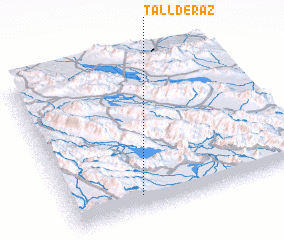 Places with similar names to Tall Derāz, Iran ::
// Daltrozów (PL)
// Dölderesi (TR)
// Tolley Terrace (US)
// Ţūl-e Derāz (IR)
// Tal‘at ar Ruzz (JO)
Disclaimer :: Information on this page comes without warranty of any kind |
||
|
Where is Tall Derāz? Elevation and coordinates ::
Latitude (lat): 30°6'3"N Longitude (lon): 52°18'26"E
Elevation (approx.): 1850m (map arrows pan, magnifying glasses zoom) |
||
|
Visiting Tall Derāz? Hotel/Accommodation ::
Book a hotel in Tall Derāz Travel Guide ::
Buy a travel guide for Iran rental cars ::
car rental offers GPS waypoint ::
download a GPX waypoint (PoI) of Tall Derāz for your GPS receiver
|
||