|
search place name
|
||
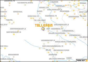
Tall-e Pā'īn (Lorestān, Iran)Tall-e Pā'īn is a town in the Lorestān region of Iran. An overview map of the region around Tall-e Pā'īn is displayed below.
regional and 3d topo map of Tall-e Pā'īn, Iran ::
Tall-e Pā'īn airports ::
The nearest airport is KSH - Bakhtaran Shahid Ashrafi Esfahani, located 144.6 km north west of Tall-e Pā'īn.
Other airports nearby include QMJ - Masjed Soleiman Shahid Asyaee (181.8 km south east), SDG - Sanandaj (235.8 km north west), Nearby towns ::
Rafī‘ (1.5km east) //
Tall-e Morādkhān (2.4km north east) //
Tall-e Mīr ‘Abbās (2.4km north east) //
Tall-e ‘Ajam (2.4km north east) //
Tall-e Amānollāh (3.7km north) //
Tall-e Sālār (3.7km north) //
Shahīd Bāhonar (3.7km north) //
Tall-e Ḩājjī Morād Khānī (4.0km north west) //
Tall-e Bālā (4.0km north west) //
Tall-e Moḩammad Mīrzā (4.0km north west) //
Tall-e ‘Alī Sabz (4.0km north west) //
Dādābād-e Soflá (5.2km south) //
Shūrāb-e ‘Olyā (4.6km east) //
Pīzelkūh (5.6km south) //
Ḩājj ‘Alī-ye Gerehbīd (5.0km east) //
Tall-e Moḩammad Yūsof (5.8km north) //
Shūrāb-e ‘Olyā (6.1km north east) //
Mīneh-ye ‘Olyā (6.8km north west) //
Rīkhān-e Do (7.4km south) //
Gholāmān-e Soflá (6.5km east) //
Rīkhān-e Seh (7.6km south) //
Mīneh-ye Soflá (7.2km north west) //
Nūrābād (7.2km north east) //
Kūmās (7.8km north) //
Sarchak-e Dādābād-e ‘Olyā (8.0km south east) //
Rīkhān-e Yek (8.0km south east) //
Gholāmān-e Soflá (9.2km north east) //
Ḩasanābād (10.6km north east) //
[all distances 'as the bird flies' and approximate]  Places with similar names to Tall-e Pā'īn, Iran ::
// Telepino (RU)
// Tolpino (RU)
// Dalapuan (PH)
// Dalipaoen (PH)
// Dalupaon (PH)
// De la Peña (PH)
// Delapeña (PH)
// Talpūnai (LT)
// Dealu Poenii (RO)
// Tălăpanu (RO)
Disclaimer :: Information on this page comes without warranty of any kind |
||
|
Where is Tall-e Pā'īn? Elevation and coordinates ::
Latitude (lat): 33°21'0"N Longitude (lon): 48°10'0"E
Elevation (approx.): 1577m (map arrows pan, magnifying glasses zoom) |
||
|
Visiting Tall-e Pā'īn? Hotel/Accommodation ::
Book a hotel in Tall-e Pā'īn Travel Guide ::
Buy a travel guide for Iran rental cars ::
car rental offers GPS waypoint ::
download a GPX waypoint (PoI) of Tall-e Pā'īn for your GPS receiver
|
||