|
search place name
|
||
Tall Khānī (Fārs, Iran)Tall Khānī is a town in the Fārs region of Iran. An overview map of the region around Tall Khānī is displayed below.
regional and 3d topo map of Tall Khānī, Iran ::

Tall Khānī airports ::
The nearest airport is SYZ - Shiraz Shahid Dastghaib Intl, located 137.3 km south east of Tall Khānī.
Other airports nearby include BUZ - Bushehr (208.7 km south west), Nearby towns ::
Manşūr Khānī (0.6km north) //
Gardaneh-ye Sībak (1.1km north) //
Pūzeh Sefīd (2.9km north west) //
Aḩmad Qalandarī (3.6km south west) //
Khārestān-e Bālā (3.9km north) //
Pahnehbehī (4.4km north) //
Kakān (4.0km west) //
Deh Now (4.3km west) //
Tang-e Jūb-e Khāleh (5.2km south) //
Kalīvar (5.4km north) //
Zardeh Khūnī (5.9km west) //
Emāmzādeh (5.9km west) //
Ḩamzehkhānī (6.4km north west) //
Jūy Khaleh Pā'īn (7.0km south east) //
Jūy Khaleh Bālā (7.7km south east) //
Ghaẕanfarkhānī (7.5km north west) //
Mūrgāh (7.5km north west) //
Kakūn (7.7km north west) //
Tall Sarbāzī (8.9km south east) //
Gowd-e Del Bālā (9.1km north east) //
[all distances 'as the bird flies' and approximate] 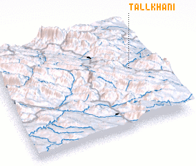 Places with similar names to Tall Khānī, Iran ::
// Talakhan (RU)
// Talkhan (RU)
// Talukhino (RU)
// Dilū Khān (IQ)
// Dalkhān (IR)
// Delah Khānī (IR)
// Delah Khānī (IR)
// Dūlkhān (IR)
// Talcahuano (CL)
// Dalkhānia (IN)
Disclaimer :: Information on this page comes without warranty of any kind |
||
|
Where is Tall Khānī? Elevation and coordinates ::
Latitude (lat): 30°36'8"N Longitude (lon): 51°51'32"E
Elevation (approx.): 2415m (map arrows pan, magnifying glasses zoom) |
||
|
Visiting Tall Khānī? Hotel/Accommodation ::
Book a hotel in Tall Khānī Travel Guide ::
Buy a travel guide for Iran rental cars ::
car rental offers GPS waypoint ::
download a GPX waypoint (PoI) of Tall Khānī for your GPS receiver
|
||