|
search place name
|
||
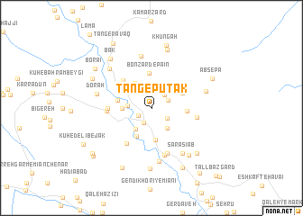
Tang-e Pūtak (Ostān-e Kohgīlūyeh va Būyer Aḩmad, Iran)Tang-e Pūtak is a town in the Ostān-e Kohgīlūyeh va Būyer Aḩmad region of Iran. An overview map of the region around Tang-e Pūtak is displayed below.
regional and 3d topo map of Tang-e Pūtak, Iran ::
Tang-e Pūtak airports ::
The nearest airport is SYZ - Shiraz Shahid Dastghaib Intl, located 202.2 km south east of Tang-e Pūtak.
Nearby towns ::
Pātāveh (1.7km south west) //
Gendīzār (2.0km south west) //
Bādengān-e Bālā (2.0km north east) //
Bādengūn-e ‘Olyā (2.2km north east) //
Samīrūn (2.1km south east) //
Sarkūnī (2.5km west) //
Chenār Bon-e Bālā (2.9km north west) //
Pey Ābzār (3.0km south east) //
Cham ‘Arabī (3.2km south west) //
Deh Kohneh-ye Sarkūnī (3.1km west) //
Deh-e Jadīd (3.5km north west) //
Sīmerūn (3.8km south west) //
Semīrūn (3.9km south) //
Deh Shīrīn (3.7km north east) //
Bādengān-e Pāʼīn (3.7km west) //
Bon Zard-e Pā'īn (4.3km north) //
Sar Tang-e Āb Zā (3.8km east) //
Chenār Barm-e Pā'īn (4.5km north west) //
Deh Sheykh (5.1km south west) //
Sar-e Tang (4.7km west) //
Deh Kohneh (4.8km west) //
Aḩmad Gharīb (5.0km east) //
Karreh (5.8km south) //
Gūr Ganjū (6.1km south) //
Bon Zard-e Bālā (6.6km north) //
Gandī Khūrī (6.7km south) //
Sar Āsīāb (6.5km south east) //
Do Rāh (6.0km west) //
Daleh Tang-e Yūtak (6.1km east) //
[all distances 'as the bird flies' and approximate] 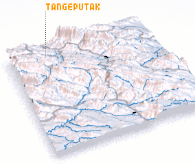 Places with similar names to Tang-e Pūtak, Iran ::
// Donji Potok (BA)
Disclaimer :: Information on this page comes without warranty of any kind |
||
|
Where is Tang-e Pūtak? Elevation and coordinates ::
Latitude (lat): 30°58'1"N Longitude (lon): 51°16'57"E
Elevation (approx.): 1720m (map arrows pan, magnifying glasses zoom) |
||
|
Visiting Tang-e Pūtak? Hotel/Accommodation ::
Book a hotel in Tang-e Pūtak Travel Guide ::
Buy a travel guide for Iran rental cars ::
car rental offers GPS waypoint ::
download a GPX waypoint (PoI) of Tang-e Pūtak for your GPS receiver
|
||