|
search place name
|
||
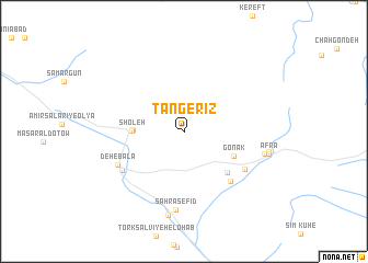
Tang-e Rīz (Fārs, Iran)Tang-e Rīz is a town in the Fārs region of Iran. An overview map of the region around Tang-e Rīz is displayed below.
regional and 3d topo map of Tang-e Rīz, Iran ::
Tang-e Rīz airports ::
The nearest airport is SYZ - Shiraz Shahid Dastghaib Intl, located 73.6 km north of Tang-e Rīz.
Other airports nearby include BUZ - Bushehr (192.7 km west), Nearby towns ::
Shabānkāreh (4.6km west) //
Sho‘leh (4.6km west) //
Gonak (5.1km south east) //
Gowd Kahlūyeh (5.7km south east) //
Pareh Zeytūn (6.6km south east) //
Tork Salvīyeh-e Bālā (6.6km south east) //
Meymand (6.8km south west) //
Deh-e Bālā (6.8km south west) //
Şaḩrā Sefīd (8.0km south) //
Chah Kūshk (7.5km east) //
Qal‘eh-ye Khalaf (8.6km south) //
Ābgol (7.8km east) //
Afrā (7.9km east) //
[all distances 'as the bird flies' and approximate] 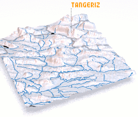 Places with similar names to Tang-e Rīz, Iran ::
// Tinajeros (ES)
// Tiengérisié (TD)
// Tinajeros (MX)
// Dangers (FR)
// (( Donji Orasi )) (CS)
// Donji Ruži°i (CS)
// Tenejeros (PH)
// Tinajeros (PH)
// Tångeråsa (SE)
// Tinajeros (AR)
Disclaimer :: Information on this page comes without warranty of any kind |
||
|
Where is Tang-e Rīz? Elevation and coordinates ::
Latitude (lat): 28°54'14"N Longitude (lon): 52°48'36"E
Elevation (approx.): 1842m (map arrows pan, magnifying glasses zoom) |
||
|
Visiting Tang-e Rīz? Hotel/Accommodation ::
Book a hotel in Tang-e Rīz Travel Guide ::
Buy a travel guide for Iran rental cars ::
car rental offers GPS waypoint ::
download a GPX waypoint (PoI) of Tang-e Rīz for your GPS receiver
|
||