|
search place name
|
||
Tarjagān (Kermān, Iran)Tarjagān is a town in the Kermān region of Iran. An overview map of the region around Tarjagān is displayed below.
regional and 3d topo map of Tarjagān, Iran ::

Tarjagān airports ::
The nearest airport is KER - Kerman, located 46.9 km north west of Tarjagān.
Nearby towns ::
Torjegān (0.0km north) //
Kāz̧emābād (0.6km west) //
Qodratābād (0.8km north west) //
Cheshmeh Kūshk (1.5km south) //
Ne‘matābād (2.0km north east) //
Ḩasanābād (2.1km south east) //
Goz̄argāh-e Bībī Gerāmī (2.2km north west) //
Zar (2.8km south east) //
Bībī Garāmī (2.7km east) //
Khankestān (3.4km south) //
Nāz̧emābād (3.5km south) //
Zahrūd (3.5km south) //
Amīrābād (4.4km north west) //
‘Askerābād (4.6km north east) //
Ḩojjatābād (5.6km north west) //
Kahnūj (5.4km north west) //
Ḩasanābād (6.4km north) //
Rūghanū'īyeh-ye Bālā (6.0km south east) //
Ḩoseynābād (9.3km south east) //
Narmegān (9.5km south east) //
Khāneh-ye Shosh (9.7km south east) //
[all distances 'as the bird flies' and approximate] 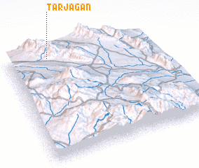
Disclaimer :: Information on this page comes without warranty of any kind |
||
|
Where is Tarjagān? Elevation and coordinates ::
Latitude (lat): 29°57'52"N Longitude (lon): 57°16'55"E
Elevation (approx.): 2335m (map arrows pan, magnifying glasses zoom) |
||
|
Visiting Tarjagān? Hotel/Accommodation ::
Book a hotel in Tarjagān Travel Guide ::
Buy a travel guide for Iran rental cars ::
car rental offers GPS waypoint ::
download a GPX waypoint (PoI) of Tarjagān for your GPS receiver
|
||