|
search place name
|
||
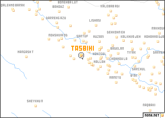
Tasbīḩī (Khūzestān, Iran)Tasbīḩī is a town in the Khūzestān region of Iran. An overview map of the region around Tasbīḩī is displayed below.
regional and 3d topo map of Tasbīḩī, Iran ::
Tasbīḩī airports ::
The nearest airport is QMJ - Masjed Soleiman Shahid Asyaee, located 105.2 km north west of Tasbīḩī.
Other airports nearby include AWZ - Ahwaz (145.3 km west), MRX - Bandar Mahshahr Mahshahr (155.4 km south west), Nearby towns ::
Deh Now-ye Kīzavak (1.1km east) //
Chaman (1.5km south east) //
Rūzarak (1.6km east) //
Amīrābād (1.7km west) //
Deh Now (2.0km north east) //
Abū ol Kheyr (2.0km south east) //
Jadval Kān (2.2km south east) //
Gūr Parvīz (2.5km south east) //
Sar Tang-e Chalāb (2.4km west) //
Darb-e Gharībī (2.9km north) //
Seh Balūtak (3.9km north) //
Sar Tūf (4.1km north) //
Ḩowẕ Gel (3.5km east) //
Bar Āftāb-e Reẕā'ī (3.8km south east) //
Gerd Qal‘eh (3.7km east) //
Shāhghāz (3.9km north east) //
Sargūf (3.9km north east) //
Mallāḩ (3.9km south east) //
Sar-e Tūl (4.1km north east) //
Seh Chārak (4.5km north) //
Līrsīāh-e Shāpūrī (4.5km north east) //
Deh-e Rūdchelū (4.6km north west) //
Mūzarī (5.1km north east) //
Cham Zarak (4.8km east) //
Līrsīāh-e Mūzarm (5.9km north) //
Sardat (5.1km east) //
Bar Āftāb-e ‘Alī Mo'men (5.2km east) //
Darreh-ye Zang (5.4km east) //
Bar Āftāb-e Z̧afarī (5.5km east) //
[all distances 'as the bird flies' and approximate] 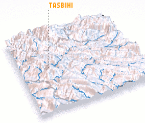 Places with similar names to Tasbīḩī, Iran ::
// Des Bhuāi (BD)
Disclaimer :: Information on this page comes without warranty of any kind |
||
|
Where is Tasbīḩī? Elevation and coordinates ::
Latitude (lat): 31°34'45"N Longitude (lon): 50°15'53"E
Elevation (approx.): 1289m (map arrows pan, magnifying glasses zoom) |
||
|
Visiting Tasbīḩī? Hotel/Accommodation ::
Book a hotel in Tasbīḩī Travel Guide ::
Buy a travel guide for Iran rental cars ::
car rental offers GPS waypoint ::
download a GPX waypoint (PoI) of Tasbīḩī for your GPS receiver
|
||