|
search place name
|
||
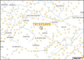
Ţāyer Sarā (Gīlān, Iran)Ţāyer Sarā is a town in the Gīlān region of Iran. An overview map of the region around Ţāyer Sarā is displayed below.
regional and 3d topo map of Ţāyer Sarā, Iran ::
Ţāyer Sarā airports ::
The nearest airport is RAS - Rasht, located 44.8 km north west of Ţāyer Sarā.
Other airports nearby include RZR - Ramsar (61.2 km south east), THR - Teheran Mehrabad Intl (197.7 km south east), Nearby towns ::
Zemīdān (0.7km north west) //
Sattārābād (1.1km north east) //
Pā'īn Fedreh (1.7km south west) //
Sar Cheshmeh (1.7km east) //
Shīrnesā' (2.2km south) //
Saţlesar (2.4km north west) //
Kūreh (2.8km south east) //
Kābījār (3.2km south east) //
Amīr Kalāyeh (3.2km north west) //
Kateh Shāl (3.2km north west) //
‘Alī Sorūd (3.6km north west) //
Kāhbījār (3.9km south east) //
Morād Dahandeh (3.5km west) //
Raḩīmābād (3.6km west) //
Līālestān (4.6km north) //
‘Alīkhān Sarā (4.8km south) //
Bījār Bāgh (4.3km north west) //
Kohrehbar (4.0km west) //
Ţālesh Maḩalleh (4.5km north east) //
Sarāsh (5.0km south) //
Bālā Fedreh (4.8km south east) //
Līārjdemeh (4.3km east) //
Qaşşāb Maḩalleh (5.2km north) //
Lūkolāyeh (4.6km north east) //
Rajab Sarā (4.8km south east) //
Lasheh (4.8km south east) //
Sīāh Rūdbār (4.8km south east) //
Gomol (5.3km south west) //
Porūsh-e Bālā (5.3km south east) //
[all distances 'as the bird flies' and approximate]  Places with similar names to Ţāyer Sarā, Iran :: Disclaimer :: Information on this page comes without warranty of any kind |
||
|
Where is Ţāyer Sarā? Elevation and coordinates ::
Latitude (lat): 37°9'31"N Longitude (lon): 50°3'57"E
Elevation (approx.): 96m (map arrows pan, magnifying glasses zoom) |
||
|
Visiting Ţāyer Sarā? Hotel/Accommodation ::
Book a hotel in Ţāyer Sarā Travel Guide ::
Buy a travel guide for Iran rental cars ::
car rental offers GPS waypoint ::
download a GPX waypoint (PoI) of Ţāyer Sarā for your GPS receiver
|
||