|
search place name
|
||
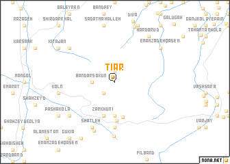
Tīār (Iran)Tīār is a town in Iran. An overview map of the region around Tīār is displayed below.
regional and 3d topo map of Tīār, Iran ::
Tīār airports ::
The nearest airport is THR - Teheran Mehrabad Intl, located 123.8 km south west of Tīār.
Other airports nearby include RZR - Ramsar (178.6 km north west), Nearby towns ::
Mamerz Kābon (1.9km north) //
Tīr Sarā (2.4km south west) //
Bandar Sokūn (3.0km west) //
Kat Kolā (5.6km south) //
Chātmeh Sar (5.8km south) //
Zarkhūnī (5.8km south) //
Chaman Ben (5.8km south) //
Gat Kolā (6.3km south) //
Sang Chāl (7.4km south) //
Shatleh (8.0km south) //
Gengerej Kolā (8.4km south) //
Sang Chāl (8.8km south) //
Emāmzādeh Qāsem (8.2km north east) //
Hardo Rūd (8.7km north east) //
Najjār Kolā (8.2km south west) //
Khalārd (8.2km north west) //
[all distances 'as the bird flies' and approximate]  Places with similar names to Tīār, Iran ::
Disclaimer :: Information on this page comes without warranty of any kind |
||
|
Where is Tīār? Elevation and coordinates ::
Latitude (lat): 36°15'0"N Longitude (lon): 52°30'0"E
Elevation (approx.): 764m (map arrows pan, magnifying glasses zoom) |
||
|
Visiting Tīār? Hotel/Accommodation ::
Book a hotel in Tīār Travel Guide ::
Buy a travel guide for Iran rental cars ::
car rental offers GPS waypoint ::
download a GPX waypoint (PoI) of Tīār for your GPS receiver
|
||