|
search place name
|
||
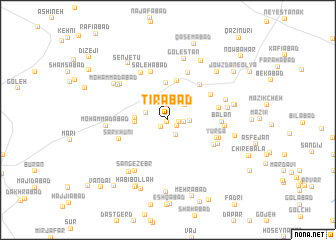
Tīrābād (Eşfahān, Iran)Tīrābād is a town in the Eşfahān region of Iran. An overview map of the region around Tīrābād is displayed below.
regional and 3d topo map of Tīrābād, Iran ::
Tīrābād airports ::
The nearest airport is AZD - Yazd Shahid Sadooghi, located 184.0 km south east of Tīrābād.
Nearby towns ::
Şāleḩābād (0.2km south west) //
Kas̄īrābād (0.2km south west) //
Shāh Kūh (1.0km south west) //
Gāleh Kajān (1.1km south east) //
Jūyābād (1.1km east) //
Fakhrābād (1.7km north) //
Naşīrābād (1.5km east) //
Shāh Kūh (1.8km south east) //
Eshkastān (2.0km east) //
Delengī (2.3km north east) //
Malakān (2.3km north east) //
Khārvān (2.2km west) //
Kejān (2.6km north west) //
Zorūgī (3.1km west) //
Maḩmūdābād (3.1km west) //
Vandīsh (4.1km north) //
Jeznābād (4.4km north) //
Feyẕābād-e Ḩājj Kāz̧em (5.0km north east) //
Kājābād (4.9km north east) //
Şāleḩābād (5.6km north) //
Jalālābād-e Golestān (5.6km north) //
Varapā-ye Pā'īn (5.1km south east) //
Yūrgā (5.0km south east) //
Dowlatābād (5.0km east) //
Sar Khūnī (5.1km south west) //
Dīkel (5.2km east) //
Āshnān (5.8km north west) //
Balān (5.1km east) //
Varapā-ye Bālā (5.4km south east) //
[all distances 'as the bird flies' and approximate] 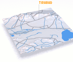 Places with similar names to Tīrābād, Iran ::
// Douar Biada (MA)
// Terebety (RU)
// Terebut (RU)
// Turabad (AZ)
// Terbat (MY)
// Turbuţa (RO)
// Dawwār Bed (TN)
// Douar Rebta (TN)
// Trabada (ES)
// Trabada (ES)
Disclaimer :: Information on this page comes without warranty of any kind |
||
|
Where is Tīrābād? Elevation and coordinates ::
Latitude (lat): 32°52'6"N Longitude (lon): 52°41'3"E
Elevation (approx.): 2280m (map arrows pan, magnifying glasses zoom) |
||
|
Visiting Tīrābād? Hotel/Accommodation ::
Book a hotel in Tīrābād Travel Guide ::
Buy a travel guide for Iran rental cars ::
car rental offers GPS waypoint ::
download a GPX waypoint (PoI) of Tīrābād for your GPS receiver
|
||