|
search place name
|
||
Tīz Āb (Ostān-e Kohgīlūyeh va Būyer Aḩmad, Iran)Tīz Āb is a town in the Ostān-e Kohgīlūyeh va Būyer Aḩmad region of Iran. An overview map of the region around Tīz Āb is displayed below.
regional and 3d topo map of Tīz Āb, Iran ::

Tīz Āb airports ::
The nearest airport is MRX - Bandar Mahshahr Mahshahr, located 184.5 km west of Tīz Āb.
Other airports nearby include QMJ - Masjed Soleiman Shahid Asyaee (199.8 km north west), SYZ - Shiraz Shahid Dastghaib Intl (221.4 km south east), Nearby towns ::
Darreh Bīd (2.2km west) //
Dam Māregūn (2.2km east) //
Bīrūkher (4.3km north) //
Borj-e Chīn (4.4km west) //
Tonbehdārī (4.7km north east) //
Jowberīz (5.1km north east) //
Dam Saqāveh (5.3km east) //
Lachūl (6.3km north west) //
Shahnīz (7.3km north) //
Āb Kāseh (6.6km south west) //
Āb Sardāb (6.8km south west) //
Mārjān (7.0km east) //
Māregūn (7.0km east) //
Nakhjīr (7.7km north west) //
Darreh Bīn (8.1km south) //
Haft Cheshmeh (8.3km north) //
Mīān Saqāveh (7.4km south east) //
Darreh Derāz (7.3km west) //
Sar Āb-e Bahāreh (7.6km west) //
Z̧afarābād (7.6km west) //
‘Azīzī-ye Bālā (8.9km south) //
Deh Now-e Dārbar (9.2km south) //
[all distances 'as the bird flies' and approximate] 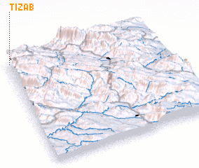 Places with similar names to Tīz Āb, Iran ::
Disclaimer :: Information on this page comes without warranty of any kind |
||
|
Where is Tīz Āb? Elevation and coordinates ::
Latitude (lat): 30°59'33"N Longitude (lon): 51°0'43"E
Elevation (approx.): 2069m (map arrows pan, magnifying glasses zoom) |
||
|
Visiting Tīz Āb? Hotel/Accommodation ::
Book a hotel in Tīz Āb Travel Guide ::
Buy a travel guide for Iran rental cars ::
car rental offers GPS waypoint ::
download a GPX waypoint (PoI) of Tīz Āb for your GPS receiver
|
||