|
search place name
|
||
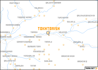
Tokhtamīsh (Khorāsān, Iran)Tokhtamīsh is a town in the Khorāsān region of Iran. An overview map of the region around Tokhtamīsh is displayed below.
regional and 3d topo map of Tokhtamīsh, Iran ::
Tokhtamīsh airports ::
The nearest airport is ASB - Ashkhabad Ashgabat, located 109.6 km east of Tokhtamīsh.
Nearby towns ::
Raḩīmdād (0.0km north) //
Āghjeh (1.7km north) //
Ostād (1.9km north) //
Kalāteh-ye Sha‘ban (3.7km south) //
Tānīr Lū (3.7km south) //
Māneh (3.5km south west) //
Kalāyen (4.4km east) //
Tappeh (4.4km west) //
Qal‘eh-ye Mamū (5.8km south) //
Qarah Jangal-e Bālā (5.8km south) //
Qareh Chāy (6.3km south east) //
‘Alīābād-e Qarahchāy (5.8km south east) //
Qaşr-e Qajar (7.4km south) //
Tāzeh Qal‘eh (7.6km north) //
Kalāteh-ye Naqdūkhān (6.2km west) //
Kashkābād (6.2km west) //
Būrbūr-e Kord (7.6km south) //
Tūp Chenār (7.1km north east) //
Būrbūr-e Tork (7.1km south west) //
Qaşrī (8.0km north) //
Fakhr od Dīn (8.0km south) //
Qarah Kānlū (8.6km north west) //
Sūlūklū (7.9km north east) //
[all distances 'as the bird flies' and approximate] 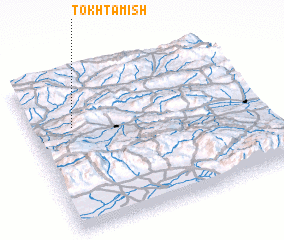 Places with similar names to Tokhtamīsh, Iran ::
// Toktamysh (RU)
// Takhtamysh (KZ)
// Takhtamysh (UZ)
// Tokhtamish (TJ)
// (( Taktamysh )) (RU)
// Takedamachi (JP)
Disclaimer :: Information on this page comes without warranty of any kind |
||
|
Where is Tokhtamīsh? Elevation and coordinates ::
Latitude (lat): 37°40'0"N Longitude (lon): 57°11'0"E
Elevation (approx.): 688m (map arrows pan, magnifying glasses zoom) |
||
|
Visiting Tokhtamīsh? Hotel/Accommodation ::
Book a hotel in Tokhtamīsh Travel Guide ::
Buy a travel guide for Iran rental cars ::
car rental offers GPS waypoint ::
download a GPX waypoint (PoI) of Tokhtamīsh for your GPS receiver
|
||