|
search place name
|
||
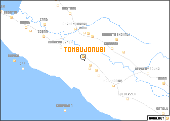
Tombū Jonūbī (Hormozgān, Iran)Tombū Jonūbī is a town in the Hormozgān region of Iran. An overview map of the region around Tombū Jonūbī is displayed below.
regional and 3d topo map of Tombū Jonūbī, Iran ::
Tombū Jonūbī airports ::
The nearest airport is KIH - Kish Island, located 144.7 km south east of Tombū Jonūbī.
Other airports nearby include BUZ - Bushehr (266.0 km north west), Nearby towns ::
Tombū Shomālī (1.5km south east) //
Akbarī (2.1km south east) //
Fāresī (3.1km south east) //
Bandū (3.6km north west) //
Sorūbāsh (4.4km south east) //
Sahmū-ye Jonūbī (5.5km north) //
Savāḩel (6.0km north) //
Konār Kheymeh (5.6km north west) //
Morū‘ (6.1km north) //
Kherreh (6.0km north east) //
Chāh-e Mobārak (7.2km north) //
Sahmū-ye Shomālī (7.7km north east) //
Koshkonār (8.0km south east) //
Jalālāt (7.8km east) //
Zārd (11.2km north west) //
[all distances 'as the bird flies' and approximate] 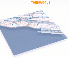 Places with similar names to Tombū Jonūbī, Iran :: Disclaimer :: Information on this page comes without warranty of any kind |
||
|
Where is Tombū Jonūbī? Elevation and coordinates ::
Latitude (lat): 27°18'1"N Longitude (lon): 52°48'24"E
Elevation (approx.): 17m (map arrows pan, magnifying glasses zoom) |
||
|
Visiting Tombū Jonūbī? Hotel/Accommodation ::
Book a hotel in Tombū Jonūbī Travel Guide ::
Buy a travel guide for Iran rental cars ::
car rental offers GPS waypoint ::
download a GPX waypoint (PoI) of Tombū Jonūbī for your GPS receiver
|
||