|
search place name
|
||
Torkābād (Yazd, Iran)Torkābād is a town in the Yazd region of Iran. An overview map of the region around Torkābād is displayed below.
regional and 3d topo map of Torkābād, Iran ::

Torkābād airports ::
The nearest airport is AZD - Yazd Shahid Sadooghi, located 56.4 km south east of Torkābād.
Nearby towns ::
Shahrābād (2.7km south) //
Aḩmadābād (2.9km north east) //
Şadrābād (5.2km south east) //
Ardakān (5.3km south east) //
Sharīfābād (6.5km south east) //
Bafrū'īyeh (7.6km south) //
Qāsemābād (7.0km north east) //
Amīrābād (9.9km south east) //
[all distances 'as the bird flies' and approximate] 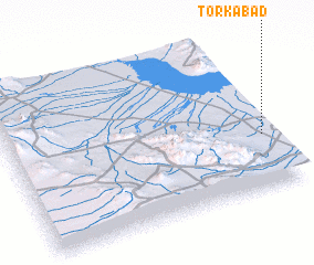 Places with similar names to Torkābād, Iran ::
// Darreh Qobād (IR)
// Torkābād (IR)
// Torkābād (IR)
// Torkābād (IR)
// Tariqābād (PK)
// Douar Akbat (MA)
// Trác Bút (VN)
// Dragboda (SE)
// Tryggeboda (SE)
Disclaimer :: Information on this page comes without warranty of any kind |
||
|
Where is Torkābād? Elevation and coordinates ::
Latitude (lat): 32°20'28"N Longitude (lon): 53°58'11"E
Elevation (approx.): 1021m (map arrows pan, magnifying glasses zoom) |
||
|
Visiting Torkābād? Hotel/Accommodation ::
Book a hotel in Torkābād Travel Guide ::
Buy a travel guide for Iran rental cars ::
car rental offers GPS waypoint ::
download a GPX waypoint (PoI) of Torkābād for your GPS receiver
|
||