|
search place name
|
||
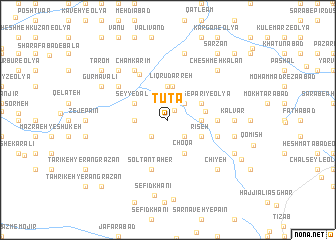
Tūtā (Lorestān, Iran)Tūtā is a town in the Lorestān region of Iran. An overview map of the region around Tūtā is displayed below.
regional and 3d topo map of Tūtā, Iran ::
Tūtā airports ::
The nearest airport is KSH - Bakhtaran Shahid Ashrafi Esfahani, located 61.1 km north west of Tūtā.
Other airports nearby include SDG - Sanandaj (147.7 km north west), Nearby towns ::
Chenār (1.2km north east) //
Bongīsū (2.4km south east) //
Dīnārābād (2.4km south east) //
Tāzehābād (2.4km north east) //
Veysābād (2.4km south west) //
Rīvāsān (3.1km east) //
Veysar (3.1km east) //
Kahrīz-e Varvasht (3.7km north) //
Tangol-e Varūneh (3.1km west) //
Līqrū Darreh (3.8km north) //
Choqā (4.0km south east) //
Rīseh (3.6km south east) //
Tang-e Parī-ye ‘Olyā (3.6km north east) //
Tang-e Parī (3.6km north east) //
Seyyed ‘Alī (3.6km north west) //
Cham Mokhtār (3.6km north west) //
Golestānak (3.6km east) //
Bangīsū (4.6km east) //
Bāgh-e Mīr Bag (4.6km east) //
Solţān Ţāher (5.8km south) //
Garmak (5.0km east) //
Jāḩātam (5.0km east) //
Cham Karīm (5.7km north west) //
Bādām Shīrīn (5.9km north west) //
Cham Karīm (6.4km north west) //
Kalvār (6.1km east) //
Balūţ Bāzeh (6.4km east) //
Cherūsh-e Ītīvand (7.6km north) //
Chīyeh (7.2km south east) //
[all distances 'as the bird flies' and approximate]  Places with similar names to Tūtā, Iran ::
Disclaimer :: Information on this page comes without warranty of any kind |
||
|
Where is Tūtā? Elevation and coordinates ::
Latitude (lat): 34°3'0"N Longitude (lon): 47°43'0"E
Elevation (approx.): 1701m (map arrows pan, magnifying glasses zoom) |
||
|
Visiting Tūtā? Hotel/Accommodation ::
Book a hotel in Tūtā Travel Guide ::
Buy a travel guide for Iran rental cars ::
car rental offers GPS waypoint ::
download a GPX waypoint (PoI) of Tūtā for your GPS receiver
|
||