|
search place name
|
||
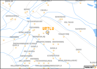
Ūrtlū (Ostān-e Āz̄arbāyjān-e Gharbī, Iran)Ūrtlū is a town in the Ostān-e Āz̄arbāyjān-e Gharbī region of Iran. An overview map of the region around Ūrtlū is displayed below.
regional and 3d topo map of Ūrtlū, Iran ::
Ūrtlū airports ::
The nearest airport is TBZ - Tabriz Intl, located 230.8 km south west of Ūrtlū.
Nearby towns ::
Tāzeh Kand-e Qadīm (1.6km west) //
Ḩājjī Ja‘far Kandī (2.3km south east) //
Khān Qeshlāqī (2.9km west) //
Pārā Qeshlāq (3.4km south west) //
‘Abd or Reẕāābād (4.0km south) //
Ḩamdollāhābād (4.0km south) //
Bahrāmābād (4.7km south east) //
Petlī Kandī (4.7km north west) //
Tāzehābād (4.7km north west) //
Yeddioymaq (4.6km east) //
Qamīshchū (4.9km west) //
Gūshlū (6.4km south) //
Tāzeh Kand-e Kīān (5.9km north west) //
Dūst Kandī (5.7km west) //
Semënovka (7.0km north east) //
Nūrābād (6.0km west) //
Fīrūzābād-e Yek (7.5km south) //
Fīrūzābād-e Do (7.5km south) //
Gūshlū (7.0km south west) //
Qızılkǝnd (7.1km north east) //
Çaxırlı (8.6km north) //
Poltavka (7.2km north east) //
Mollā Kandī (9.4km south west) //
Bir May (10.9km north west) //
[all distances 'as the bird flies' and approximate]  Places with similar names to Ūrtlū, Iran ::
Disclaimer :: Information on this page comes without warranty of any kind |
||
|
Where is Ūrtlū? Elevation and coordinates ::
Latitude (lat): 39°40'0"N Longitude (lon): 48°2'0"E
Elevation (approx.): 25m (map arrows pan, magnifying glasses zoom) |
||
|
Visiting Ūrtlū? Hotel/Accommodation ::
Book a hotel in Ūrtlū Travel Guide ::
Buy a travel guide for Iran rental cars ::
car rental offers GPS waypoint ::
download a GPX waypoint (PoI) of Ūrtlū for your GPS receiver
|
||