|
search place name
|
||
Varmāl (Sīstān va Balūchestān, Iran)Varmāl is a town in the Sīstān va Balūchestān region of Iran. An overview map of the region around Varmāl is displayed below.
regional and 3d topo map of Varmāl, Iran ::

Varmāl airports ::
The nearest airport is ZAH - Zahedan Intl, located 146.4 km south of Varmāl.
Nearby towns ::
Ḩasan Ājān (1.3km south west) //
Shāh Jahān (1.8km south west) //
Ḩasanābād (1.8km south west) //
Dowrān Khān (2.2km south east) //
Şafar-e Barqī (2.6km north) //
Deh-e Ākhūnd (2.6km north east) //
Borjak (3.0km south) //
Seyyedkhān (3.7km north east) //
Barqī (4.3km north east) //
Posht-e Dasht (4.5km north east) //
Dasht-e Kabūtarān (5.1km south west) //
Shīr Moḩammad-e Lūtak (5.1km east) //
Dūr Moḩammad (5.6km north east) //
Shahr-e Golī (6.1km north east) //
Mollā Naz̧ar (6.3km north east) //
Nūr Moḩammad (6.7km north east) //
Lūţak (6.8km east) //
Maḩmūdābād (7.9km north east) //
Ḩoseynābād-e Bālā (8.7km north east) //
Shāhī (9.3km north east) //
Ḩājjī ‘Az̧īm (8.6km north east) //
Gol Moḩammad (9.6km north east) //
[all distances 'as the bird flies' and approximate] 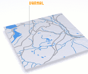 Places with similar names to Varmāl, Iran ::
Disclaimer :: Information on this page comes without warranty of any kind |
||
|
Where is Varmāl? Elevation and coordinates ::
Latitude (lat): 30°44'36"N Longitude (lon): 61°19'51"E
Elevation (approx.): 478m (map arrows pan, magnifying glasses zoom) |
||
|
Visiting Varmāl? Hotel/Accommodation ::
Book a hotel in Varmāl Travel Guide ::
Buy a travel guide for Iran rental cars ::
car rental offers GPS waypoint ::
download a GPX waypoint (PoI) of Varmāl for your GPS receiver
|
||