|
search place name
|
||
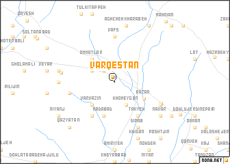
Varqestān (Hamadān, Iran)Varqestān is a town in the Hamadān region of Iran. An overview map of the region around Varqestān is displayed below.
regional and 3d topo map of Varqestān, Iran ::
Varqestān airports ::
The nearest airport is SDG - Sanandaj, located 181.8 km west of Varqestān.
Other airports nearby include KSH - Bakhtaran Shahid Ashrafi Esfahani (205.0 km south west), RAS - Rasht (220.5 km north), RZR - Ramsar (225.6 km north east), Nearby towns ::
Tāzeh Kand (2.4km north west) //
Khomeygān (4.0km south) //
Qānqānlū (3.5km north west) //
Varvazīn (4.8km south west) //
Ommatlar (4.8km north west) //
Razan (4.8km south east) //
Mādābād (5.8km south) //
Āq Kand (6.3km south west) //
Takyeh (6.3km south east) //
Vafs (7.4km north) //
Qāţer Owlan (6.3km west) //
Yengeh Qal‘eh (7.1km south east) //
Sīrāb (8.0km south) //
Fārsejīn (7.1km south east) //
Chālboqā (7.3km west) //
Navār (8.2km south east) //
Qāz Yātān (9.6km south west) //
[all distances 'as the bird flies' and approximate] 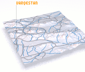
Disclaimer :: Information on this page comes without warranty of any kind |
||
|
Where is Varqestān? Elevation and coordinates ::
Latitude (lat): 35°24'0"N Longitude (lon): 49°0'0"E
Elevation (approx.): 1866m (map arrows pan, magnifying glasses zoom) |
||
|
Visiting Varqestān? Hotel/Accommodation ::
Book a hotel in Varqestān Travel Guide ::
Buy a travel guide for Iran rental cars ::
car rental offers GPS waypoint ::
download a GPX waypoint (PoI) of Varqestān for your GPS receiver
|
||