|
search place name
|
||
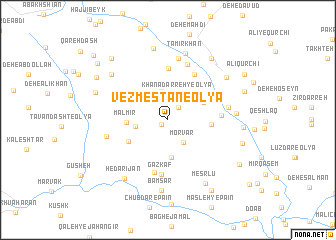
Vezmestān-e ‘Olyā (Iran)Vezmestān-e ‘Olyā is a town in Iran. An overview map of the region around Vezmestān-e ‘Olyā is displayed below.
regional and 3d topo map of Vezmestān-e ‘Olyā, Iran ::
Vezmestān-e ‘Olyā airports ::
The nearest airport is QMJ - Masjed Soleiman Shahid Asyaee, located 192.7 km south of Vezmestān-e ‘Olyā.
Nearby towns ::
Vazmestān-e Soflá (0.8km south west) //
Khanādarreh-ye Vasaţ (1.7km north east) //
Morvār (2.9km south east) //
Khanādarreh-ye ‘Olyā (3.0km north) //
Darreh Chūbāsheh (3.3km north) //
Gol-e Zard-e Mālmīr (3.1km west) //
Gol-e Zard-e Mālmīr (3.1km west) //
Revesht (4.2km south) //
Khanādarreh-ye Soflá (3.8km north east) //
Mālmīr (3.8km west) //
Qal‘eh Now-ye Raḩīm Khānī (4.1km east) //
Qal‘eh Now-ye Karīmbak (4.1km east) //
Meşrlū (4.4km south west) //
Golbedāq (5.7km north) //
Khamestān (5.6km north east) //
Areklū (5.0km east) //
Bāmsar-e Bālā (6.0km south) //
Gaz Kāf (6.1km south) //
Sārjelū (6.5km north) //
Khenā Darreh-ye Vosţá (5.7km east) //
Qal‘eh-ye Teymūr Khān (7.0km north) //
Eskandarlū (7.0km north) //
Bon-e Gonbad (6.0km west) //
Ta‘mīr Khān (7.6km north) //
Deh-e Kalbī (6.4km east) //
Bāmsar (7.9km south) //
Deh-e Mowlā (7.3km north west) //
Deh-e Kharābeh Kan (8.1km north) //
Hendūdar (7.2km north east) //
[all distances 'as the bird flies' and approximate] 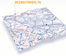 Places with similar names to Vezmestān-e ‘Olyā, Iran :: Disclaimer :: Information on this page comes without warranty of any kind |
||
|
Where is Vezmestān-e ‘Olyā? Elevation and coordinates ::
Latitude (lat): 33°44'16"N Longitude (lon): 49°10'23"E
Elevation (approx.): 2188m (map arrows pan, magnifying glasses zoom) |
||
|
Visiting Vezmestān-e ‘Olyā? Hotel/Accommodation ::
Book a hotel in Vezmestān-e ‘Olyā Travel Guide ::
Buy a travel guide for Iran rental cars ::
car rental offers GPS waypoint ::
download a GPX waypoint (PoI) of Vezmestān-e ‘Olyā for your GPS receiver
|
||