|
search place name
|
||
Yakhdān (Yazd, Iran)Yakhdān is a town in the Yazd region of Iran. An overview map of the region around Yakhdān is displayed below.
regional and 3d topo map of Yakhdān, Iran ::

Yakhdān airports ::
The nearest airport is AZD - Yazd Shahid Sadooghi, located 45.2 km south east of Yakhdān.
Nearby towns ::
Ḩasanābād (0.2km south west) //
Akbarābād (0.4km north east) //
Maḩmūdābād (0.9km east) //
Mehrjard (1.2km south west) //
Fīrūzābād (1.4km south) //
Amīrābād (1.4km north) //
Dehābād (1.4km north west) //
Shāhjīnābād (1.7km north east) //
Maḩalleh-ye Āsīāb (1.6km north west) //
Meybod (1.9km south) //
Khāneqāh (2.3km south west) //
Shūrak (2.2km east) //
Bārjīn (2.4km south east) //
Yakhdān (2.8km west) //
Bīdeh (3.0km south west) //
Mehr Jerd (2.9km west) //
Ḩasanābād (3.1km west) //
Shāhābād (3.2km south east) //
Deh Āb (3.3km west) //
Bafrū'īyeh (3.8km north west) //
Deh Sheykhī (4.2km south) //
Badrābād (5.4km south) //
Mehrābād (5.4km south east) //
Kāz̧emābād (6.5km south) //
Şadrābād (6.5km north) //
Sharīfābād (6.8km north) //
Roknābād (7.1km south east) //
Ardakān (8.1km north) //
Shahrābād (9.0km north west) //
[all distances 'as the bird flies' and approximate] 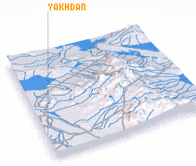 Places with similar names to Yakhdān, Iran ::
Disclaimer :: Information on this page comes without warranty of any kind |
||
|
Where is Yakhdān? Elevation and coordinates ::
Latitude (lat): 32°14'54"N Longitude (lon): 54°1'5"E
Elevation (approx.): 1071m (map arrows pan, magnifying glasses zoom) |
||
|
Visiting Yakhdān? Hotel/Accommodation ::
Book a hotel in Yakhdān Travel Guide ::
Buy a travel guide for Iran rental cars ::
car rental offers GPS waypoint ::
download a GPX waypoint (PoI) of Yakhdān for your GPS receiver
|
||