|
search place name
|
||
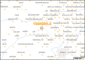
Yowrqānlū (Ostān-e Āz̄arbāyjān-e Gharbī, Iran)Yowrqānlū is a town in the Ostān-e Āz̄arbāyjān-e Gharbī region of Iran. An overview map of the region around Yowrqānlū is displayed below.
regional and 3d topo map of Yowrqānlū, Iran ::
Yowrqānlū airports ::
The nearest airport is TBZ - Tabriz Intl, located 122.0 km north east of Yowrqānlū.
Other airports nearby include VAN - Van (173.2 km north west), Nearby towns ::
Zeynālū (0.0km north) //
Gajīn (1.9km south) //
Tīzkharāb (1.5km west) //
Pīrmorād (2.4km south east) //
Darazam (2.4km south west) //
Ḩājjīābād (2.4km north east) //
Valendeh-e ‘Olyā (3.7km south) //
Badelbū (3.7km north) //
Bālājī (3.5km south west) //
Āshnāābād (3.5km south west) //
Lūr (3.5km south west) //
Vaqāşlū-ye Soflá (4.0km south) //
Valendeh-e Soflá (4.0km south) //
Faqībeyglū (4.0km north) //
Tāzeh Kand-e Qeshlāq (4.0km north) //
Tāzeh Kand-e Qāţerchī (4.0km north) //
Qāţerchī (4.0km north) //
Ārmūdāghāj (4.0km north) //
Jehatlū (4.7km south east) //
Tāzeh Kand-e Janīzeh (4.7km north west) //
Yowrqānlū-ye Janīzeh (4.7km north west) //
Janīzeh (4.7km north west) //
Bārbīn (4.7km north east) //
Gardābād (4.4km east) //
Kavsī (5.6km north) //
Nāzlū (5.6km north) //
Qezel ‘Āsheq (4.8km south east) //
Gowzgavand (4.8km south west) //
Anhar-e ‘Olyā (5.8km south) //
[all distances 'as the bird flies' and approximate] 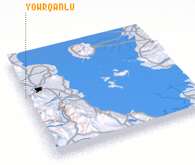 Places with similar names to Yowrqānlū, Iran ::
// Yaraguanal (CU)
Disclaimer :: Information on this page comes without warranty of any kind |
||
|
Where is Yowrqānlū? Elevation and coordinates ::
Latitude (lat): 37°38'0"N Longitude (lon): 45°0'0"E
Elevation (approx.): 1367m (map arrows pan, magnifying glasses zoom) |
||
|
Visiting Yowrqānlū? Hotel/Accommodation ::
Book a hotel in Yowrqānlū Travel Guide ::
Buy a travel guide for Iran rental cars ::
car rental offers GPS waypoint ::
download a GPX waypoint (PoI) of Yowrqānlū for your GPS receiver
|
||