|
search place name
|
||
Yūzestān-e Bālā (Eşfahān, Iran)Yūzestān-e Bālā is a town in the Eşfahān region of Iran. An overview map of the region around Yūzestān-e Bālā is displayed below.
regional and 3d topo map of Yūzestān-e Bālā, Iran ::

Yūzestān-e Bālā airports ::
The nearest airport is AZD - Yazd Shahid Sadooghi, located 170.4 km south east of Yūzestān-e Bālā.
Nearby towns ::
Kahnū'īyeh (0.6km south east) //
Şeydābād (0.7km north west) //
Ḩardavī (0.8km north east) //
Yūzestān-e Pā'īn (0.9km south) //
Deh Now (1.2km south east) //
Ḩājj Raḩīm (1.3km south west) //
Cham (1.6km south) //
Solţān Naşīr (1.3km west) //
Mardavī (1.4km north west) //
Arvar (1.8km south east) //
Kheyrābād (2.8km north west) //
Golābād (3.0km south) //
Sangīj (3.2km north east) //
Zardeh (3.2km north west) //
Kamābād (3.7km north west) //
Parīkān (3.6km east) //
Sa‘dābād (3.8km north west) //
Golchī (4.4km south) //
Sheykhābād (4.3km north east) //
Ebrāhīm ‘Alī-ye Pā'īn (4.9km north) //
Kamālābād (4.4km west) //
‘Abbāsābād (4.4km west) //
Khātūnābād (4.7km south east) //
Pedandestān (5.1km north east) //
Chīr-e Bālā (5.1km north west) //
Asfejān (5.3km north west) //
Gojeh (5.6km south west) //
Gonū'īyeh (5.1km east) //
Sheykhābād (5.6km north east) //
[all distances 'as the bird flies' and approximate] 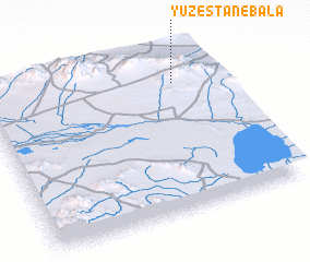 Places with similar names to Yūzestān-e Bālā, Iran :: Disclaimer :: Information on this page comes without warranty of any kind |
||
|
Where is Yūzestān-e Bālā? Elevation and coordinates ::
Latitude (lat): 32°48'37"N Longitude (lon): 52°48'48"E
Elevation (approx.): 2235m (map arrows pan, magnifying glasses zoom) |
||
|
Visiting Yūzestān-e Bālā? Hotel/Accommodation ::
Book a hotel in Yūzestān-e Bālā Travel Guide ::
Buy a travel guide for Iran rental cars ::
car rental offers GPS waypoint ::
download a GPX waypoint (PoI) of Yūzestān-e Bālā for your GPS receiver
|
||