|
search place name
|
||
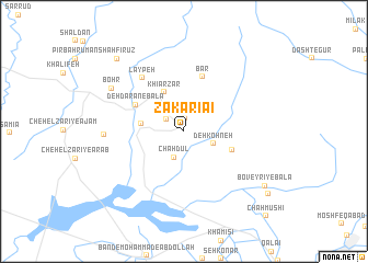
Zakarīā'ī (Ostān-e Būshehr, Iran)Zakarīā'ī is a town in the Ostān-e Būshehr region of Iran. An overview map of the region around Zakarīā'ī is displayed below.
regional and 3d topo map of Zakarīā'ī, Iran ::
Zakarīā'ī airports ::
The nearest airport is BUZ - Bushehr, located 61.1 km south of Zakarīā'ī.
Other airports nearby include SYZ - Shiraz Shahid Dastghaib Intl (157.5 km east), MRX - Bandar Mahshahr Mahshahr (211.6 km north west), Nearby towns ::
Sar Khareh (1.4km north) //
Ākā Shāh Ḩeydar (2.0km north west) //
Chāh Dūl (2.8km south) //
Moḩammad Jamālī (3.2km north west) //
Deh Kohneh (2.9km south east) //
Dehdārān-e Pā'īn (3.9km west) //
Khīār Zār (4.3km north west) //
Deh Kohneh (4.7km south east) //
Dehdārān-e Bālā (5.0km north west) //
Bār (5.8km north) //
Lāypeh (6.6km north west) //
‘Aţeybeh (7.1km west) //
Bohr (7.8km north west) //
Boveyrī-ye Bālā (9.1km south east) //
Shāh Fīrūz (9.5km north west) //
Boveyrī-ye Pā'īn (9.9km south east) //
Chāh Mūshī (11.3km south east) //
[all distances 'as the bird flies' and approximate] 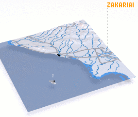 Places with similar names to Zakarīā'ī, Iran ::
Disclaimer :: Information on this page comes without warranty of any kind |
||
|
Where is Zakarīā'ī? Elevation and coordinates ::
Latitude (lat): 29°29'1"N Longitude (lon): 50°57'58"E
Elevation (approx.): 29m (map arrows pan, magnifying glasses zoom) |
||
|
Visiting Zakarīā'ī? Hotel/Accommodation ::
Book a hotel in Zakarīā'ī Travel Guide ::
Buy a travel guide for Iran rental cars ::
car rental offers GPS waypoint ::
download a GPX waypoint (PoI) of Zakarīā'ī for your GPS receiver
|
||