|
search place name
|
||
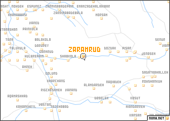
Zāram Rūd (Iran)Zāram Rūd is a town in Iran. An overview map of the region around Zāram Rūd is displayed below.
regional and 3d topo map of Zāram Rūd, Iran ::
Zāram Rūd airports ::
The nearest airport is THR - Teheran Mehrabad Intl, located 191.7 km south west of Zāram Rūd.
Nearby towns ::
Saqandī Kolā (1.2km north west) //
Rūd Bār Kolā (1.9km north) //
Kal Qūchāl (2.4km north east) //
Shab Kolā (3.0km west) //
Dozdak (4.8km north east) //
‘Alamdār Deh (6.5km south) //
Āhū Dasht (5.3km west) //
Pahneh Kolā-ye Shomālī (6.0km west) //
Sar Kat (6.2km west) //
Aḩmadābād (6.2km east) //
Varand (7.8km south) //
Golūrd (7.0km south west) //
Khar Chang (7.4km south west) //
Naqīb Deh (7.6km south east) //
Garm Rūd (6.9km west) //
Garmestān (7.0km west) //
Now Deh (8.5km south west) //
Rīg Cheshmeh (9.5km south west) //
Tākām (10.5km south west) //
[all distances 'as the bird flies' and approximate] 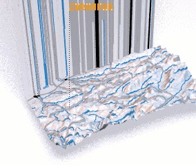 Places with similar names to Zāram Rūd, Iran ::
// Xramort (AZ)
// Cerro Morado (PA)
// Sarmörd (IQ)
// Sara Maradi (NE)
// Sar Mūrd (IR)
// Sūrmūrd (IR)
// Zahrā Mordeh (IR)
// Saramardou (GN)
// Surimorta (PG)
Disclaimer :: Information on this page comes without warranty of any kind |
||
|
Where is Zāram Rūd? Elevation and coordinates ::
Latitude (lat): 36°26'0"N Longitude (lon): 53°14'0"E
Elevation (approx.): 338m (map arrows pan, magnifying glasses zoom) |
||
|
Visiting Zāram Rūd? Hotel/Accommodation ::
Book a hotel in Zāram Rūd Travel Guide ::
Buy a travel guide for Iran rental cars ::
car rental offers GPS waypoint ::
download a GPX waypoint (PoI) of Zāram Rūd for your GPS receiver
|
||