|
search place name
|
||
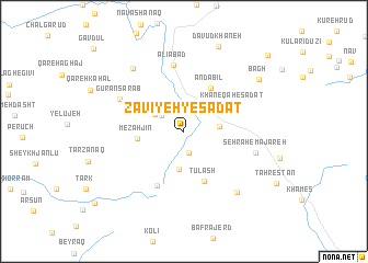
Zāvīyeh-ye Sādāt (Ardabīl, Iran)Zāvīyeh-ye Sādāt is a town in the Ardabīl region of Iran. An overview map of the region around Zāvīyeh-ye Sādāt is displayed below.
regional and 3d topo map of Zāvīyeh-ye Sādāt, Iran ::
Zāvīyeh-ye Sādāt airports ::
The nearest airport is RAS - Rasht, located 100.2 km east of Zāvīyeh-ye Sādāt.
Nearby towns ::
Belīl (2.2km south) //
Fajrābād (2.5km north west) //
Khalkhāl (3.0km north) //
Fajrābād (2.9km north west) //
Āb-e Zarī (2.9km north west) //
Khūjīn (2.9km east) //
Ālhāshem-e Soflá (3.9km south) //
Mezahjīn (3.9km west) //
Andabīl (4.9km north east) //
Ţūlāsh (5.3km south) //
Khāneqāh-e Sādāt (4.7km north east) //
Ālhāshem-e ‘Olyā (5.9km south) //
‘Alīābād (6.8km north) //
Gūrān Sarāb (6.2km north west) //
Sehrāh-e Majareh (6.2km east) //
Khāneqāh-e Bafrājerd (7.5km south east) //
Sanjabadleh (7.6km north west) //
Dāvūd Khāneh (9.1km north) //
Bāgh (8.1km north east) //
Karā Rūd (10.4km north east) //
[all distances 'as the bird flies' and approximate] 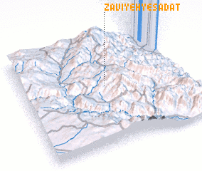 Places with similar names to Zāvīyeh-ye Sādāt, Iran :: Disclaimer :: Information on this page comes without warranty of any kind |
||
|
Where is Zāvīyeh-ye Sādāt? Elevation and coordinates ::
Latitude (lat): 37°35'6"N Longitude (lon): 48°31'15"E
Elevation (approx.): 1930m (map arrows pan, magnifying glasses zoom) |
||
|
Visiting Zāvīyeh-ye Sādāt? Hotel/Accommodation ::
Book a hotel in Zāvīyeh-ye Sādāt Travel Guide ::
Buy a travel guide for Iran rental cars ::
car rental offers GPS waypoint ::
download a GPX waypoint (PoI) of Zāvīyeh-ye Sādāt for your GPS receiver
|
||