|
search place name
|
||
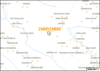
Zharīzhbān (Lorestān, Iran)Zharīzhbān is a town in the Lorestān region of Iran. An overview map of the region around Zharīzhbān is displayed below.
regional and 3d topo map of Zharīzhbān, Iran ::
Zharīzhbān airports ::
The nearest airport is KSH - Bakhtaran Shahid Ashrafi Esfahani, located 79.0 km north west of Zharīzhbān.
Other airports nearby include SDG - Sanandaj (174.4 km north), QMJ - Masjed Soleiman Shahid Asyaee (247.2 km south east), Nearby towns ::
Basāţ ‘Alī (1.7km north) //
‘Abbās Khū (1.8km north west) //
Valīmoḩammad (2.2km east) //
Kargaz (5.1km north east) //
‘Alī Bābā (5.5km south east) //
Ḩoseynkhān (6.5km north east) //
Pīrī Chenārān (7.2km north) //
Eslāmābād (6.6km south east) //
Bahrām (6.6km south east) //
Cham Qūleh (7.7km south) //
Darmareh (6.6km east) //
Pīrī Sūkhtehzār (8.0km north east) //
Tekyeh Ẕarūn (7.1km west) //
Serenjeleh (7.1km west) //
Pīrī Reẕā (8.9km north east) //
Ben Jūb-e Pīāmen (8.8km north west) //
Cheshmeh-ye Mīrzā Ḩoseyn (10.3km south east) //
Chāl Āb (10.4km south west) //
[all distances 'as the bird flies' and approximate]  Places with similar names to Zharīzhbān, Iran :: Disclaimer :: Information on this page comes without warranty of any kind |
||
|
Where is Zharīzhbān? Elevation and coordinates ::
Latitude (lat): 33°46'9"N Longitude (lon): 47°39'35"E
Elevation (approx.): 1593m (map arrows pan, magnifying glasses zoom) |
||
|
Visiting Zharīzhbān? Hotel/Accommodation ::
Book a hotel in Zharīzhbān Travel Guide ::
Buy a travel guide for Iran rental cars ::
car rental offers GPS waypoint ::
download a GPX waypoint (PoI) of Zharīzhbān for your GPS receiver
|
||