|
search place name
|
||
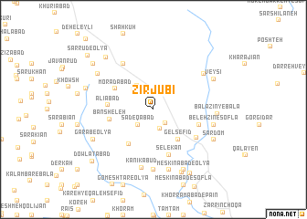
Zīrjūbī (Ostān-e Kermānshāh, Iran)Zīrjūbī is a town in the Ostān-e Kermānshāh region of Iran. An overview map of the region around Zīrjūbī is displayed below.
regional and 3d topo map of Zīrjūbī, Iran ::
Zīrjūbī airports ::
The nearest airport is SDG - Sanandaj, located 65.7 km north east of Zīrjūbī.
Other airports nearby include KSH - Bakhtaran Shahid Ashrafi Esfahani (66.9 km south east), Nearby towns ::
Badrābād (2.0km north) //
Borhān od Dīn (2.1km south east) //
Bābā ‘Azīz (2.4km south) //
Şādeqābād (2.4km south west) //
Kānī Khaẕrān (3.1km north west) //
Benāvaj (3.4km north west) //
Gel Sefīd (4.4km south east) //
Kānī Kechkīneh (5.0km south west) //
Morādābād (4.6km north west) //
Bānsheleh (4.6km west) //
‘Alīābād (4.6km west) //
Selekān (5.8km south) //
Bāvekeh (4.9km east) //
Ravānsar (5.6km south east) //
Boncheleh (6.3km north west) //
Kānī Kabūd (7.2km south) //
Khānīleh (7.4km south) //
Kharājīān (6.6km north east) //
Belehzīn-e Soflá (6.4km east) //
Shahrak-e Qalānjeh (7.6km south) //
Bālāzīn-ye Bālā (6.5km east) //
Kaley (7.1km north west) //
Garāb-e ‘Olyā (7.1km south west) //
Kalāveh (7.1km north east) //
Veysī (7.1km north east) //
Sardom (7.1km south east) //
Meskīnābād-e ‘Olyā (8.0km south) //
Garāb-e Soflá (7.1km south west) //
Bānchīā-ye ‘Olyā (7.1km south west) //
[all distances 'as the bird flies' and approximate] 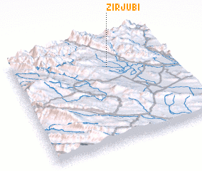 Places with similar names to Zīrjūbī, Iran ::
// Sar Jūb (IR)
// Sarjūb (IR)
// Sare Jawbeh (GM)
// Sare Jowbe (GM)
// Sarjīb (YE)
// Sare Gêba (GW)
// Sare Jaba (GW)
// Sare Jaiba (GW)
// Sare Jaubè (GW)
// Sare Jaubè (GW)
Disclaimer :: Information on this page comes without warranty of any kind |
||
|
Where is Zīrjūbī? Elevation and coordinates ::
Latitude (lat): 34°45'0"N Longitude (lon): 46°37'0"E
Elevation (approx.): 1393m (map arrows pan, magnifying glasses zoom) |
||
|
Visiting Zīrjūbī? Hotel/Accommodation ::
Book a hotel in Zīrjūbī Travel Guide ::
Buy a travel guide for Iran rental cars ::
car rental offers GPS waypoint ::
download a GPX waypoint (PoI) of Zīrjūbī for your GPS receiver
|
||