|
search place name
|
||
Al Khiḑr (Al ‘Āşimah, Kuwait)Al Khiḑr is a town in the Al ‘Āşimah region of Kuwait. An overview map of the region around Al Khiḑr is displayed below.
regional and 3d topo map of Al Khiḑr, Kuwait ::

Al Khiḑr airports ::
The nearest airport is KWI - Kuwait Intl, located 40.7 km south west of Al Khiḑr.
Other airports nearby include ABD - Abadan (100.7 km north), BSR - Basrah Intl (134.6 km north west), MRX - Bandar Mahshahr Mahshahr (146.9 km north east), AWZ - Ahwaz (212.6 km north), Nearby towns ::
Al Bulţ (1.0km south west) //
Qullat Shujayr (1.2km south east) //
Ad Dasht (2.5km east) //
Az Zawr (2.8km south west) //
Ash Shubaykah (3.8km south) //
[all distances 'as the bird flies' and approximate] 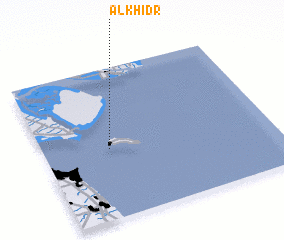 Places with similar names to Al Khiḑr, Kuwait ::
// Al Khiḑr (IQ)
// Al Khiḑr (IQ)
// Al Khaḑrah (EG)
// Al Khaţţārah (EG)
// Al Khaţţārah (EG)
// Al Khuḑayrī (EG)
// Al Khayḑar (SA)
// Al Ukhayḑir (SA)
// Aulakh Uttār (PK)
// Al Khadirah (OM)
Disclaimer :: Information on this page comes without warranty of any kind |
||
|
Where is Al Khiḑr? Elevation and coordinates ::
Latitude (lat): 29°27'52"N Longitude (lon): 48°17'18"E
Elevation (approx.): 1m (map arrows pan, magnifying glasses zoom) |
||
|
Visiting Al Khiḑr? Hotel/Accommodation ::
Book a hotel in Al Khiḑr Travel Guide ::
Buy a travel guide for Kuwait rental cars ::
car rental offers GPS waypoint ::
download a GPX waypoint (PoI) of Al Khiḑr for your GPS receiver
|
||