|
search place name
|
||
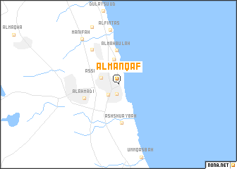
Al Manqaf (Al Wafrah, Kuwait)Al Manqaf is a town in the Al Wafrah region of Kuwait. An overview map of the region around Al Manqaf is displayed below.
regional and 3d topo map of Al Manqaf, Kuwait ::
Al Manqaf airports ::
The nearest airport is KWI - Kuwait Intl, located 21.5 km north west of Al Manqaf.
Other airports nearby include ABD - Abadan (141.6 km north), BSR - Basrah Intl (167.4 km north), MRX - Bandar Mahshahr Mahshahr (189.5 km north east), Nearby towns ::
Al Fuḩayḩīl (1.5km south) //
Al Badawīyah (2.2km south west) //
Aş Şabāḩīyah (2.6km north west) //
Abū Ḩulayfah (4.1km north) //
Al Mahbūlah (5.4km north) //
Al Aḩmadī (5.2km south west) //
Ash Shu‘aybah (6.1km south) //
Ar Riqqah (6.7km north west) //
Al Finţās (8.7km north) //
Manīfah (8.8km north west) //
[all distances 'as the bird flies' and approximate] 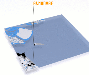 Places with similar names to Al Manqaf, Kuwait :: Disclaimer :: Information on this page comes without warranty of any kind |
||
|
Where is Al Manqaf? Elevation and coordinates ::
Latitude (lat): 29°5'46"N Longitude (lon): 48°7'58"E
Elevation (approx.): 15m (map arrows pan, magnifying glasses zoom) |
||
|
Visiting Al Manqaf? Hotel/Accommodation ::
Book a hotel in Al Manqaf Travel Guide ::
Buy a travel guide for Kuwait rental cars ::
car rental offers GPS waypoint ::
download a GPX waypoint (PoI) of Al Manqaf for your GPS receiver
|
||